The IAT Thru Hike
By Matt Tibbits on July 27, 2011
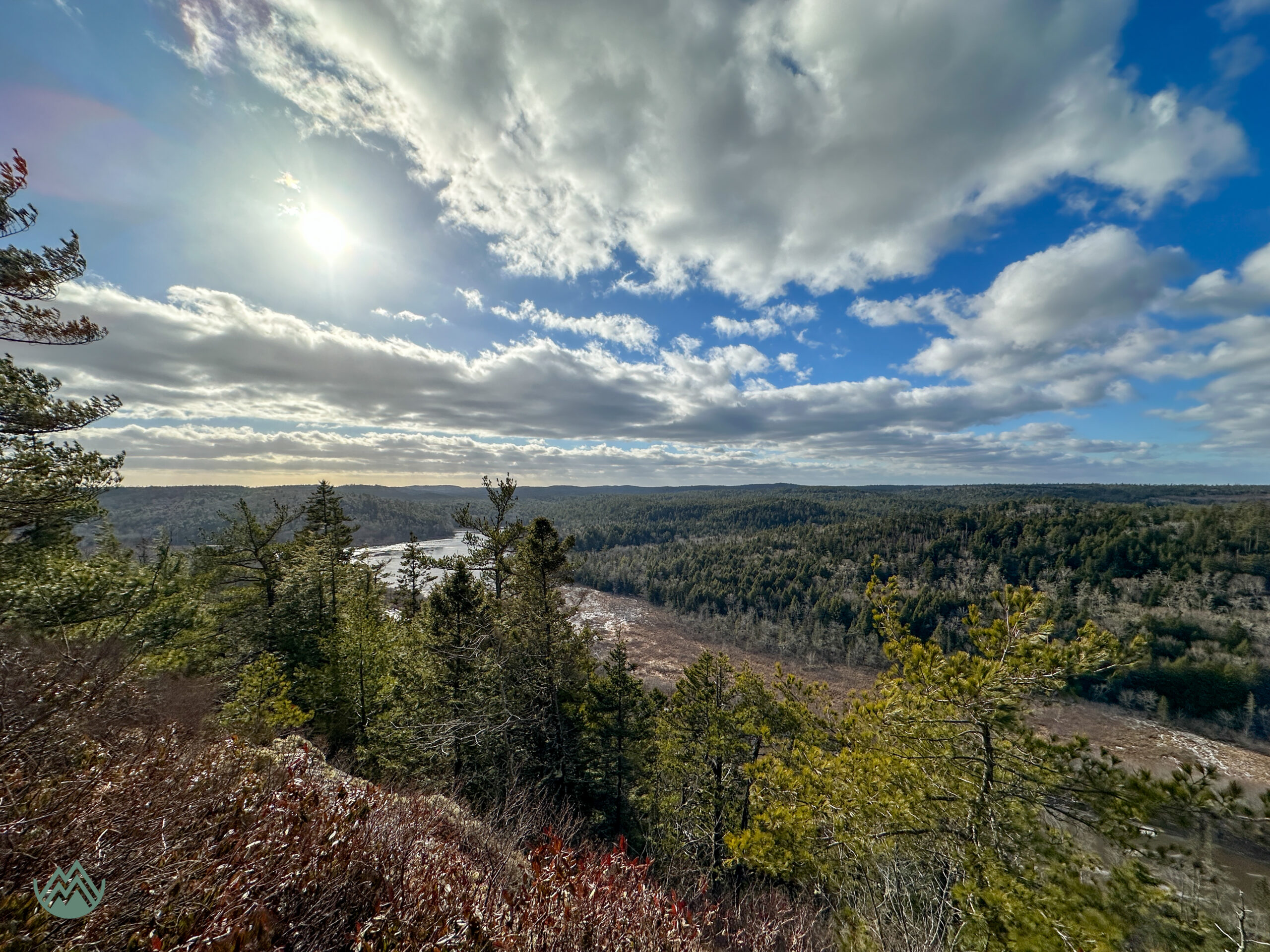
What Is The IAT?
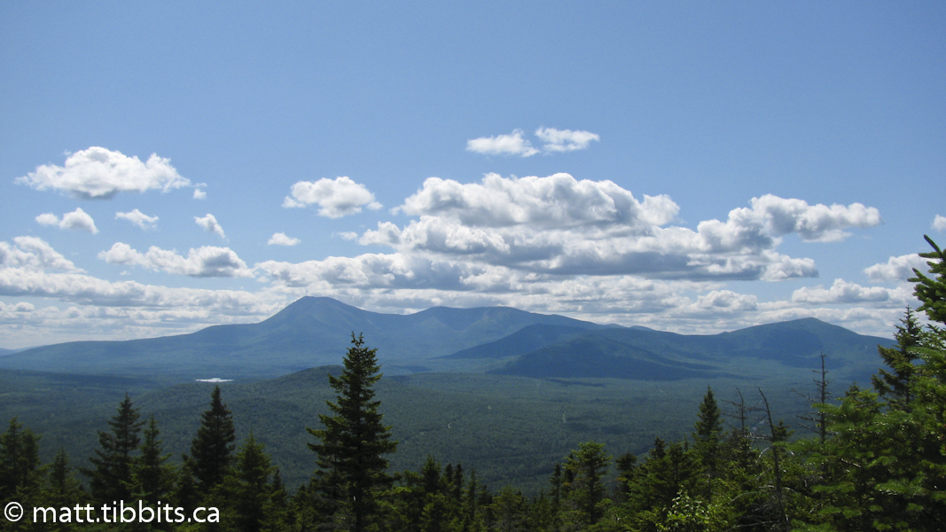
This is my account of hiking the Maine section of the International Appalachian Trail in July of 2011. The International Appalachian Trail, or IAT, is not to be confused with the famous 2180 mile Appalachian Trail that runs from Springer Mountain, Georgia to Mt. Katahdin, Maine. Rather, the IAT is a continuation of this trail that starts at the summit of Mt. Katahdin and extends across Maine into Canada, where it traverses the province of New Brunswick and the Gaspé Peninsula of Quebec. Thus, the “international” aspect of the trail.
The trail has recently been extended even further to cross the provinces of PEI, Nova Scotia, and Newfoundland, and now has sections in various countries of Europe.
More information can be found on the IAT website.
Mission: Thru-hike The IAT Maine
I first heard about the IAT a few years back and immediately wanted to thru-hike the 1200 km trail from Mt. Katahdin to the tip of the Gaspé in Quebec. After postponing the trip several times due to injury, I thought that this would be the year that I would actually be able to do it. As I started planning it soon became clear that I was not going to be able to take enough time off work to do a 1200 km hike, so I decided to tackle one section at a time, starting with the 220 km section through Maine from Mt. Katahdin to Perth-Andover, NB.
Everything seemed to come together for an early July departure date. My original plan was to start in Baxter State Park on July 8th, 2011. I had heard that it was difficult to secure reservations in the park, and that you should do so 3-4 months before your stay. So I called BSP way back in April to secure a campsite. I’m not sure that the woman I spoke to understood me because she said that it was too early to reserve and that I would be fine reserving about 6 weeks in advance. Well, when I tried to reserve 6 weeks before my trip it was a different story. Most sites were already taken. After a lengthy phone conversation I was able to secure a site at Roaring Brook campground for Thursday July 7th. This meant leaving a day early, but at least I would be able to camp in the park.
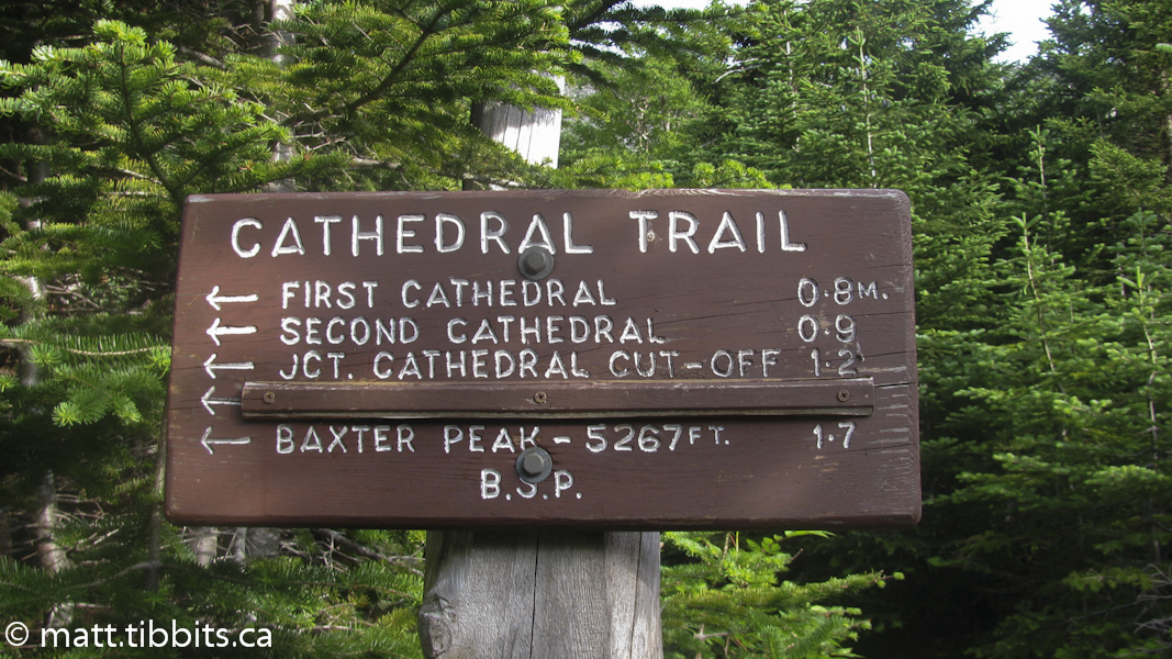
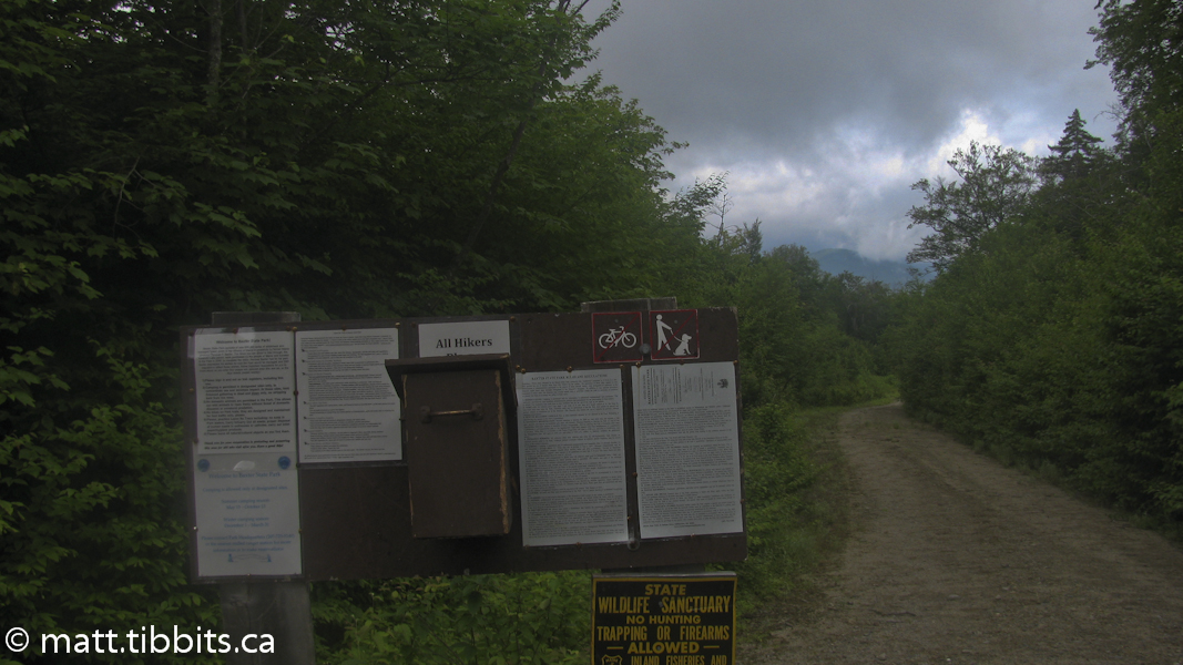
When planning to hike the Maine section of the IAT, you absolutely need to review the information on the Maine chapter of the IAT’s website. Under the “trail guides” section you will find a very descriptive guide to the trail, along with maps of Baxter State Park and the entire trail through Maine. Without this info, I would have definitely had a hard time finding my way.
Day 1 – Roaring Brook Campground
On Thursday, July 11th, I arrived at Baxter State Park. I arranged for my uncle to drop me off as I would be hiking back to NB. It was about 240 km from Fredericton to the campground and took about 3 hours to drive, including a 45 minute delay at the border. Having been years since I was in BSP, I wasn’t quite sure what to expect, especially after hearing some complaints as to how the park staff is very strict. I have to say that this is not true at all. All park staff that I encountered were very courteous and welcoming. The evening I arrived I spoke with a ranger named Russ to discuss my hiking plans and he was very helpful. He even let me arrange to leave my food bag in his cabin so that I wouldn’t have to carry it up the mountain the next day. This dropped my pack to about 28lbs (12.7kg) for the ascent of Katahdin. That extra bit of weight off of my pack would prove to make the day much more enjoyable.
Once I made camp and settled in it all felt a bit surreal. You plan for, and look forward to, a trip for so long, and before you know it there are with a long 9-10 days of hiking and adventure ahead of you. I had been looking forward to summitting Katahdin as one of the highlights of this hike, and so after a relaxing supper I hit the sack early in anticipation of this climb the next day.
Day 2 – Mt. Katahdin & Katahdin Lake Trail
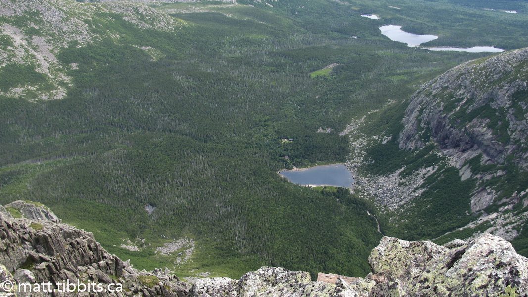
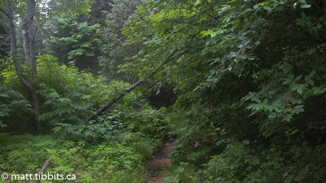
On Friday, July 12, I started up the trail at 5:45am. I estimated that I would have about 20 km of hiking today, with a large portion of that being on the mountain. From the campground I headed up the Chimney Pond Trail to the start of the famous (or infamous) Cathedral Trail. I was looking forward to seeing Chimney Pond as one of my early childhood memories is climbing the mountain with my Dad and stopping here for a snack. I also planned on a water resupply at the pond before heading up, but somehow I missed it. I figured out later that you have to take a short side trail when you reach the start of the Cathedral Trail. So I found myself on the mountain without a full supply of water. I decided to press on and ration my water until I could find some more on the way down.
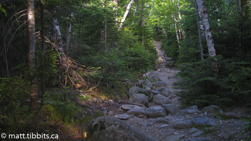

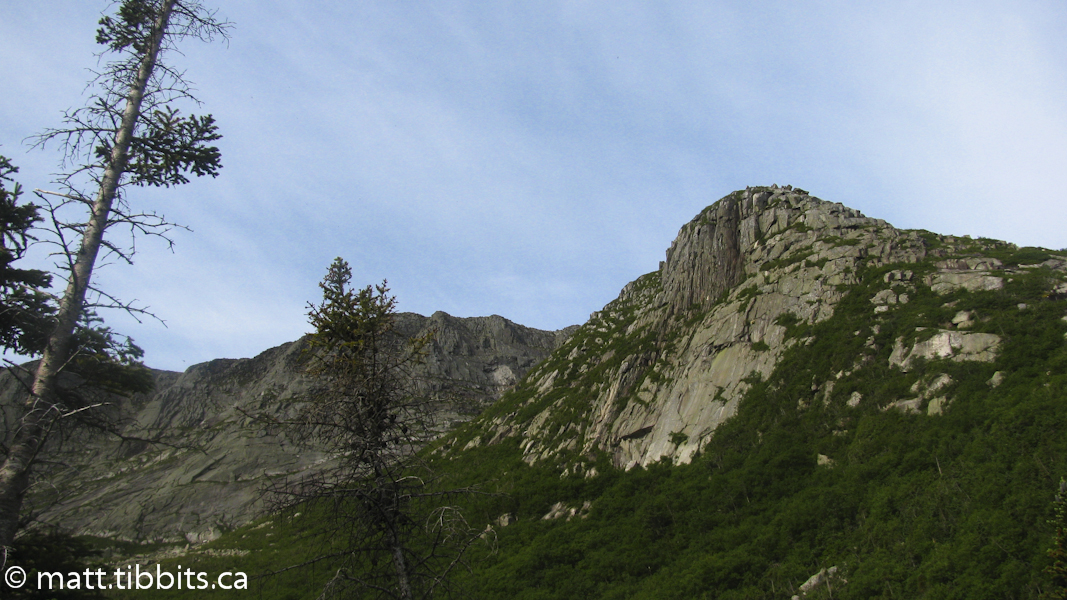
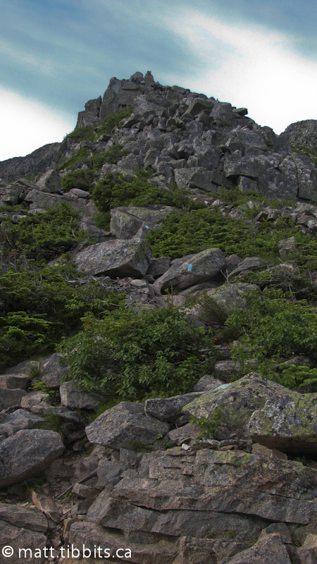
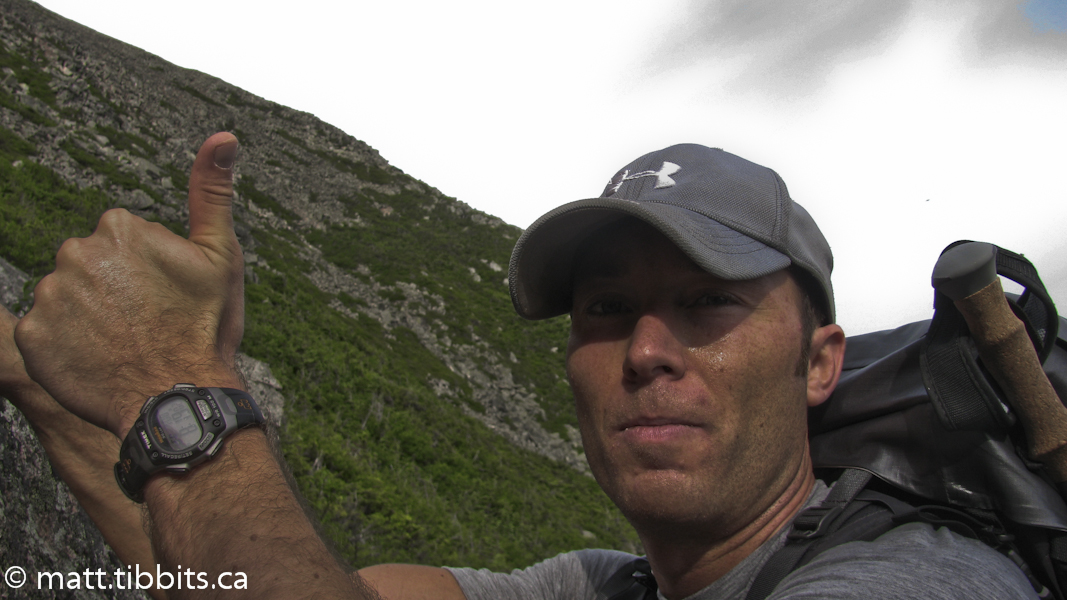
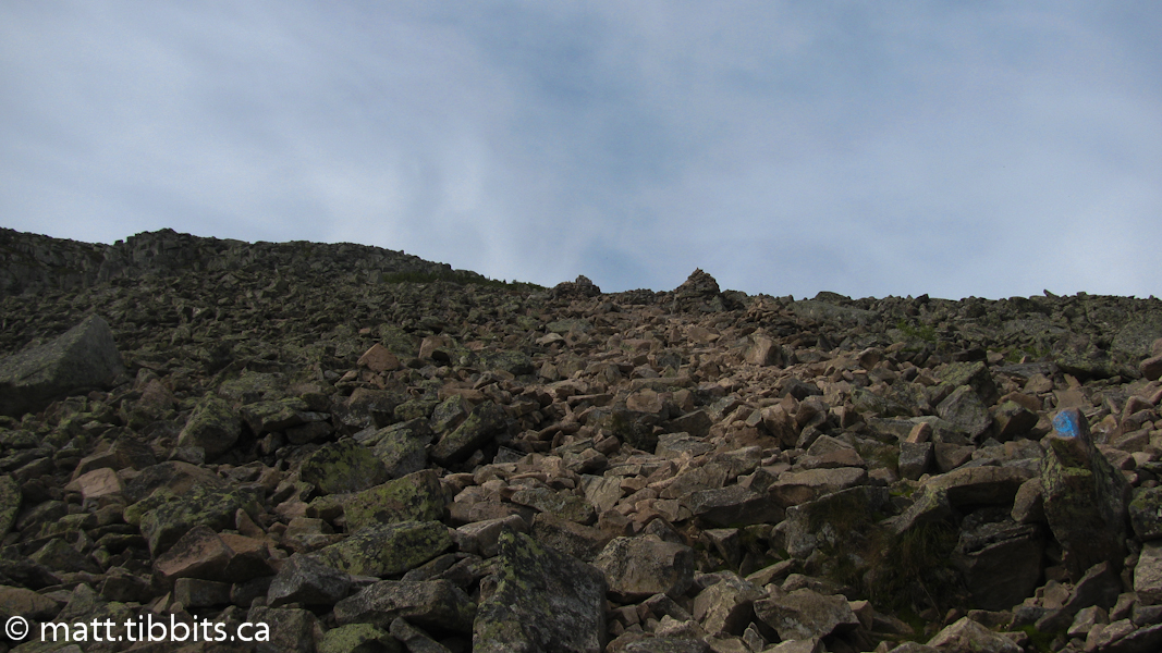
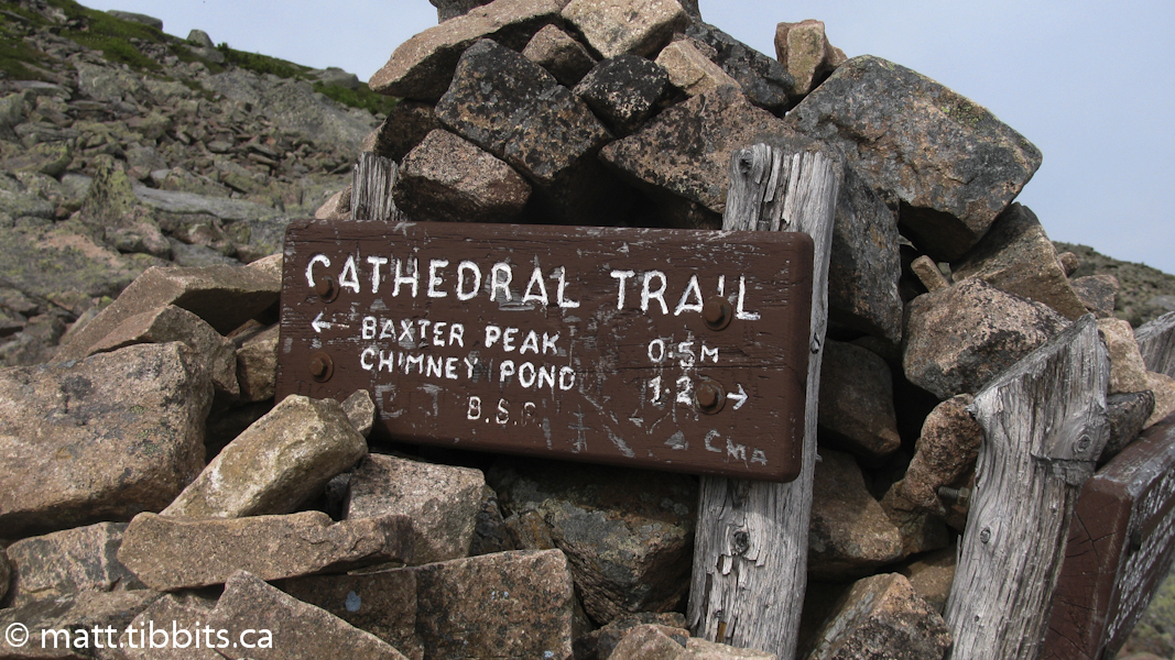
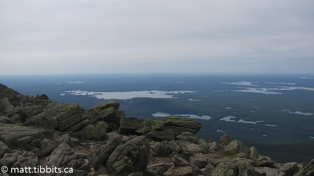
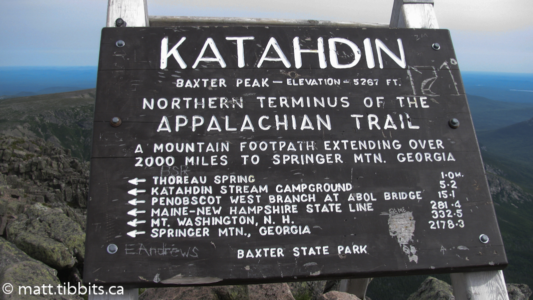
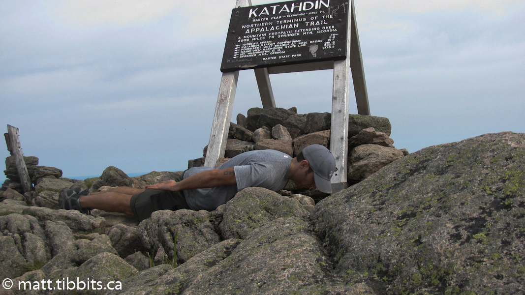
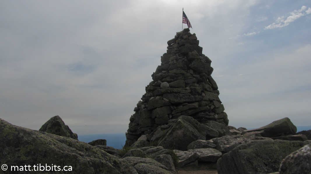
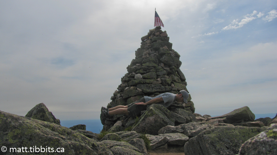
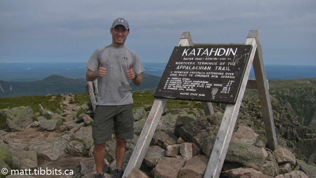
The Cathedral Trail is a bit of a challenge and lots of fun. You definitely have to CLIMB up this trail, using both hands and both feet. After scrambling over the first couple humongous rocks, I packed away the walking stick as it was just getting in the way. It was about 2.5 km to the summit. In retrospect I might have pushed myself a bit too hard up the mountain, and arrived on the summit of Baxter Peak at 9:15am – 3.5 hours after leaving Roaring Brook.
After enjoying some solitude on the summit, the next person up was a guy named Tommy from Indiana, who was just starting his southbound hike of the Appalachian Trail. I joked that he only had about 2200 miles to go, whereas all I had to do now was walk home.
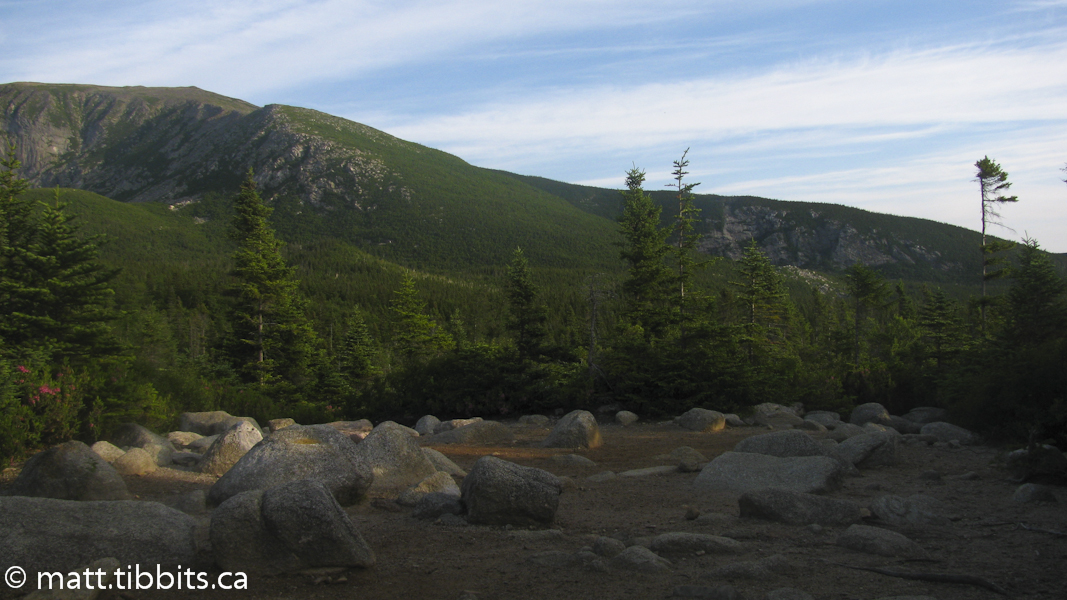
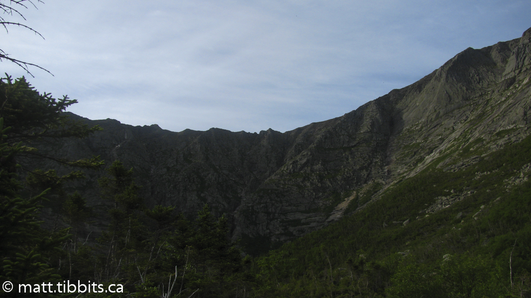
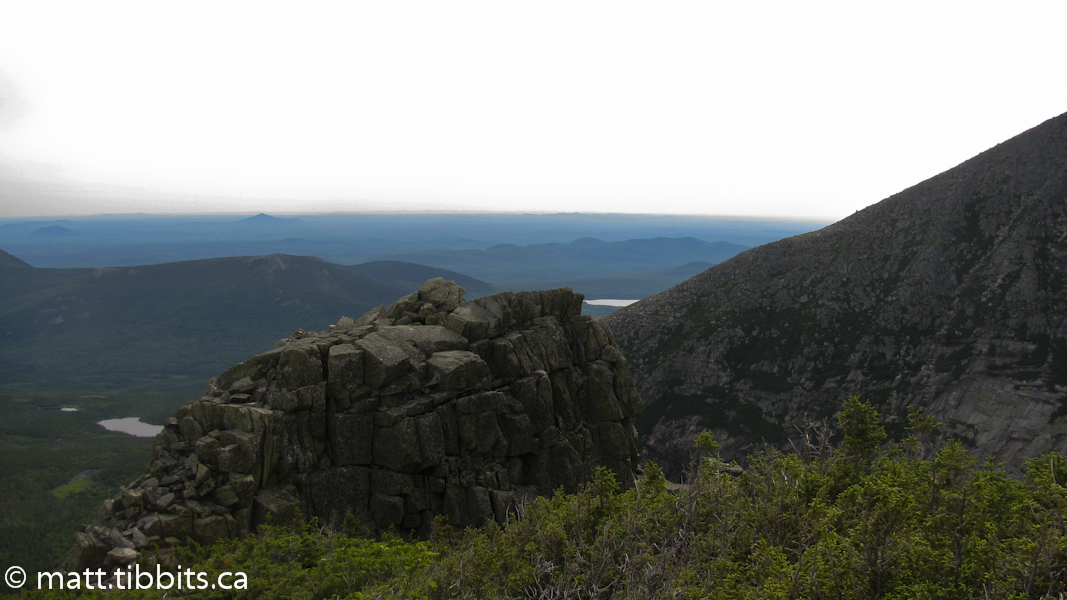
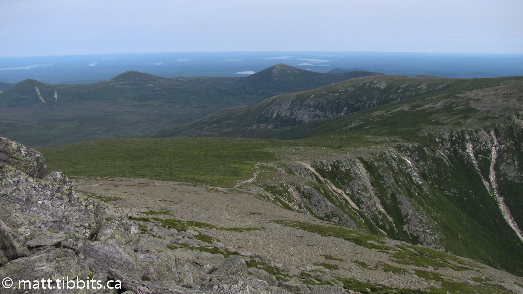
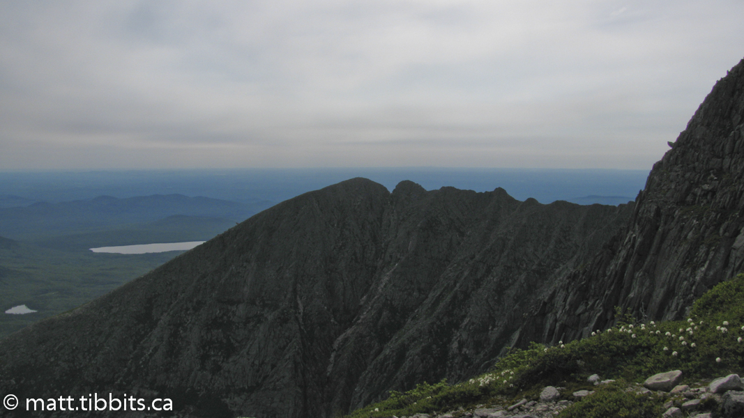
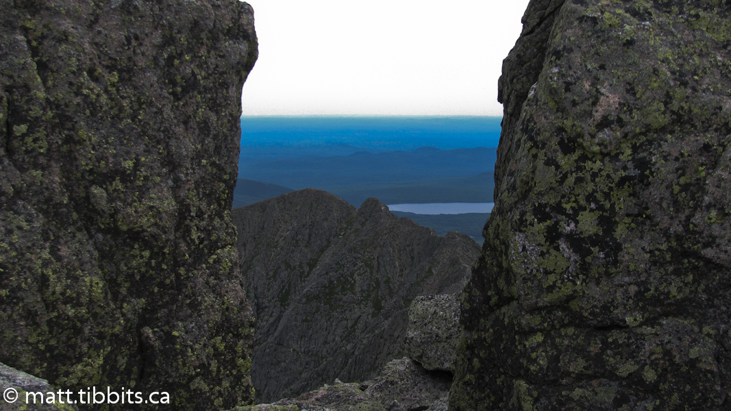
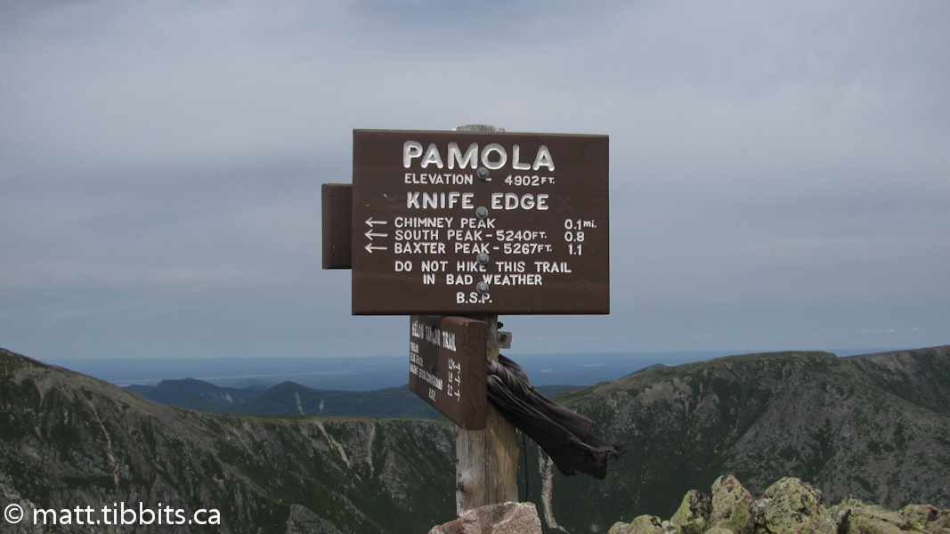
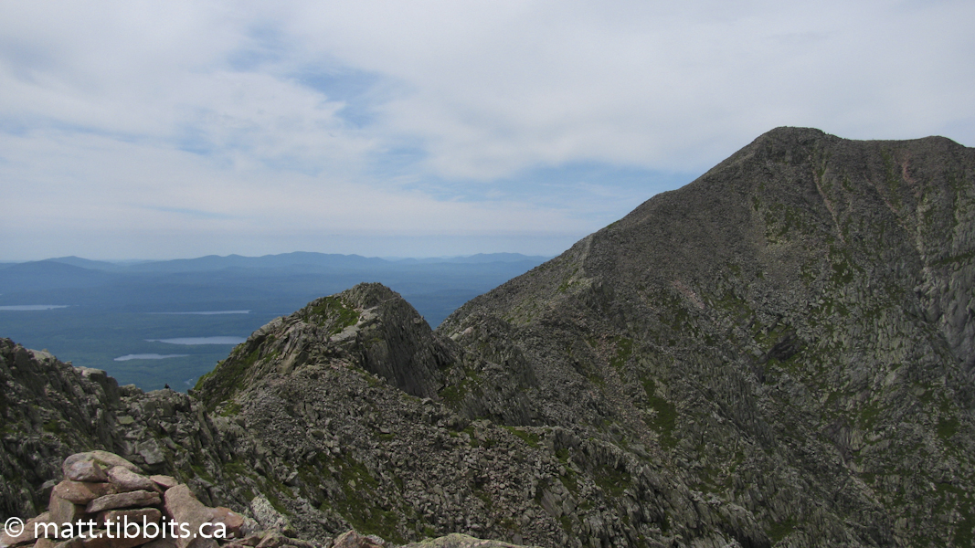
I took about an hour break on the summit and then headed out on the Knife’s Edge, a ridge that spans from Baxter Peak to Pamola Peak, something that I had always wanted to hike, but was never able to due to weather conditions. I wouldn’t recommend this part of the mountain if you have vertigo. There is a very long drop on either side of the ridge. Anyway, not one to let something like that bother me, I took off towards Pamola Peak like a mountain goat, jumping from rock to rock. It really wasn’t that bad of a climb. By the time I reached Chimney Peak, though, my legs were feeling like Jello. The short section over Chimney Peak to Pamola Peak is a bit hairy, but if you are careful it’s not a problem.
I reached Pamola Peak around 11:15am, having crossed the Knife Edge in about an hour. After a much needed break, I headed down Helon Taylor trail. I was feeling pretty beat on the way down and I still had a long way to go before day’s end. It’s funny how the little things can lift your spirits. I met a group of kids coming up the trail as I was going down. Actually I heard them long before I saw them. One of them was groaning about all the climbing and asked me if “there was anything” to see at the top. For some reason that seemed incredibly hilarious to me. While trying not to seem like a complete lunatic, I told him there was a “bit of a view” once you got to the top. About 10 minutes later I ran out of water and started feeling crappy again.
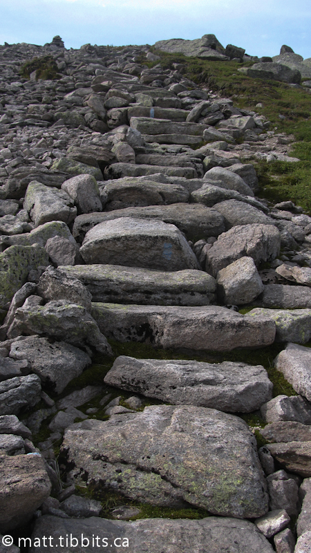
The Helon Taylor Trail seemed to go on forever. It goes down, and around, with lots of big, ugly rocks to scramble over. My knees and my mood seemed to be worsening in direct proportion to each other. About half way down I slipped on a rock and felt a sharp pain in my right Achilles. I kept going in hopes that I hadn’t seriously injured myself, and the pain seemed to subside. Eventually I came to a small stream where I was able to resupply on water and have a bit of a break. From there the descent seemed to go much better. I arrived back at Roaring Brook Campground at 1:50pm. I had hiked 14.5 km over Mt. Katahdin and back to my starting point in just over 8 hours.

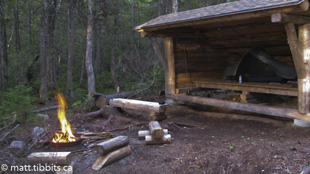
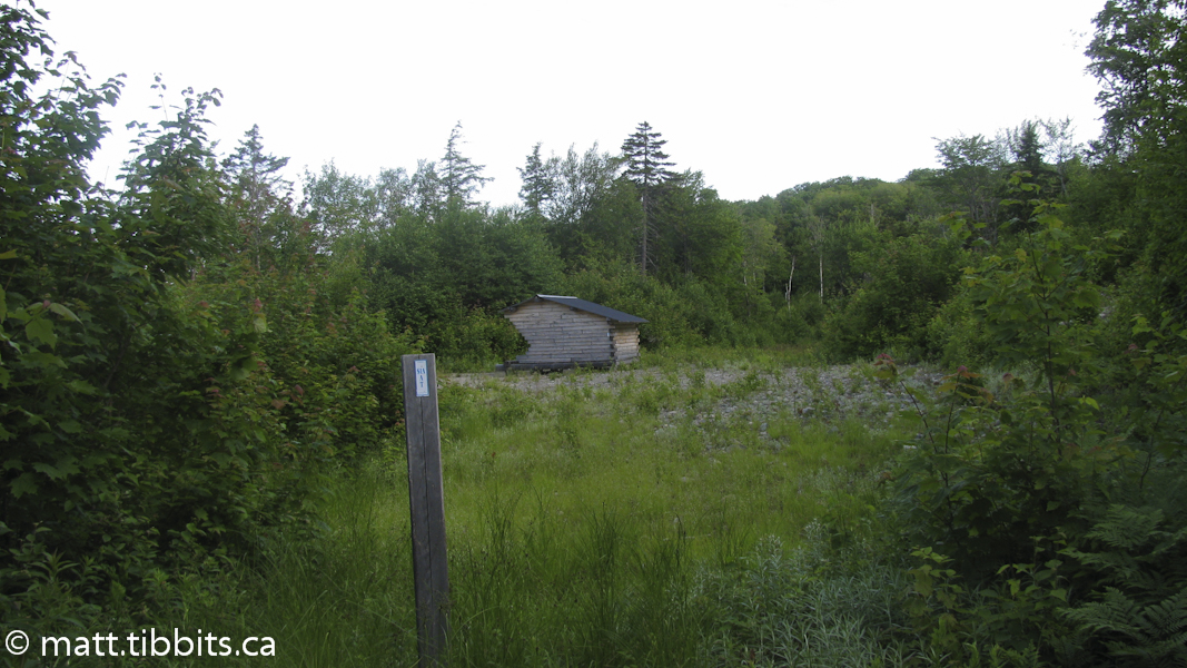
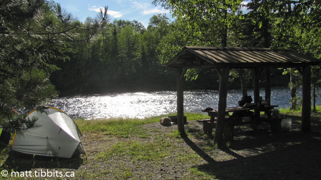
The plan was to stay in a lean-to that I had reserved at Katahdin Lake, a distance of another 7 km from the campground. I briefly debated trying to stay at Roaring Brook, but after another snack and a break, I decided keep on truckin’. I left the campground around 2:30pm and arrived at Katahdin Lake at 4pm. The trail is fairly flat and well maintained, and apparently a breeding ground for some freaky large mosquitoes. If I stopped for even a second I was instantly stung in what seemed like 10 or 15 different places. The only thing to do was apply a liberal amount of DEET and keep moving.
The only tricky part to the trail is when you come to a “Y” right before the lean-to. The trail to the right leads to Katahdin Lake Wilderness Camps, which is where you need to go to exit the park. However, to get to the lake and the South Katahdin Lake lean-to you have to go to the left. There is also a privy located right here. When heading towards the lean-to it is only about another 400m from this spot.
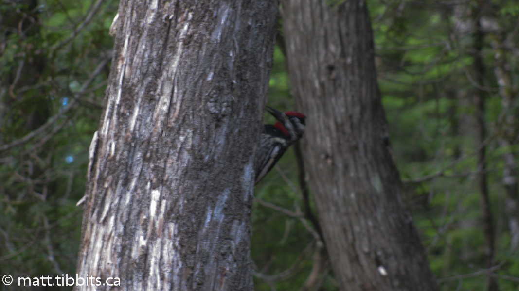
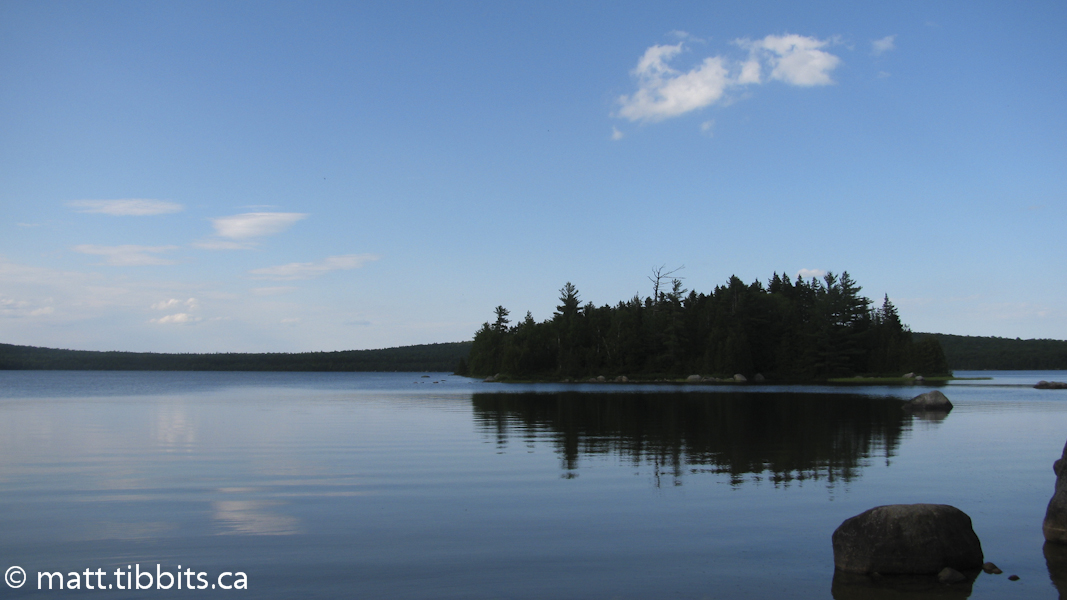
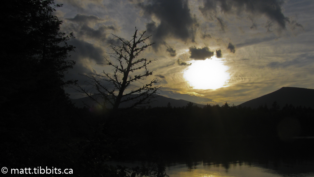
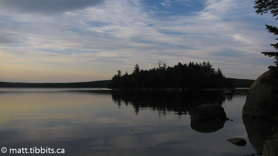
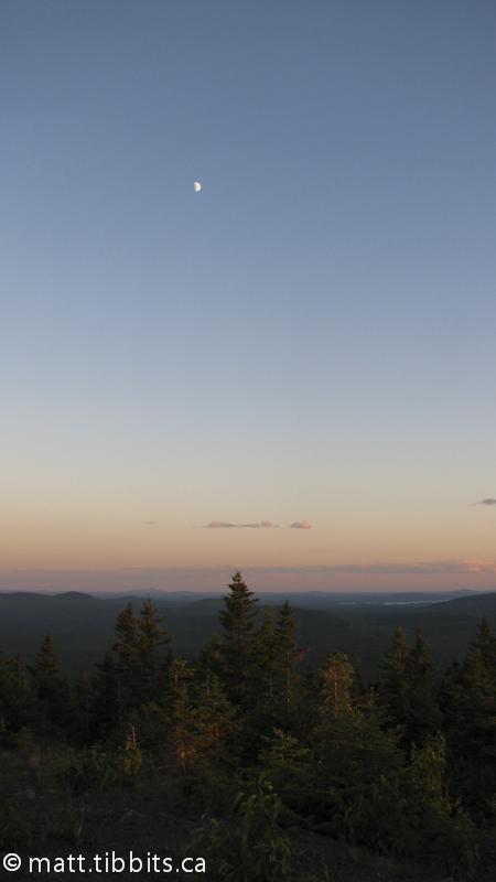
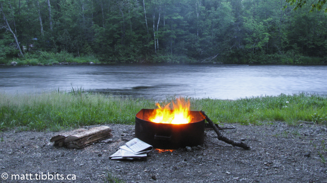
This is an absolutely beautiful campsite. After a long day of hiking it was very peaceful, with the only sound being that of the resident woodpecker and the loons out on the lake. It was also very solitary. There was no doubt that there wasn’t another soul for miles, which can at first be a bit overwhelming. I was able to scrounge around and find enough dry wood to get a fire going, before cooking some supper. It made me think of how a campfire must have brought similar comfort to those on the edge of the frontier. No matter how far from home, no matter how alone, a fire will always lift the spirit on those dark, lonely nights.
Total mileage for day 2: 21.4km (12.75mi)
Day 3 – Katahdin Lake to Deasey Mtn.
Saturday, July 9th, dawned rainy and wet. At least I was in a lean-to so it was very easy to pack up without anything getting damp. That was pretty much the only good thing about this morning. I started out on the trail around 7:30am and continued past Katahdin Lake Wilderness Camps, where you enter a large clearing with several cabins. There wasn’t any clear sign of where to go, so I followed straight across the clearing, where you do come to a trail. I followed this swampy, disgusting trail to the end where there is a very fast flowing brook that outlets from Katahdin Lake. There was an old, rickety log across the brook, which I started to inch across when I had the thought that something was very wrong. I couldn’t imagine this being the actual IAT, and I couldn’t remember anything in the guide about crossing a brook like this. Using my map and compass, I realized that I was most definitely NOT on the trail. After backtracking over the same miserable, swampy trail all the way to the camps, I was able to relocate the trail.
When coming from the lean-to and arriving in the clearing for Katahdin Lake Wilderness Camps, you have to turn to the right just past the first shed, where you will see some marking tape. The trail here is blazed in blue as is standard in Baxter Park. The trail that I first took was NOT blazed which should have been my first clue. I was pretty grumpy at having hiked about 5km on the wrong trail, but relieved to have found my way.
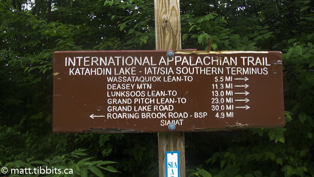
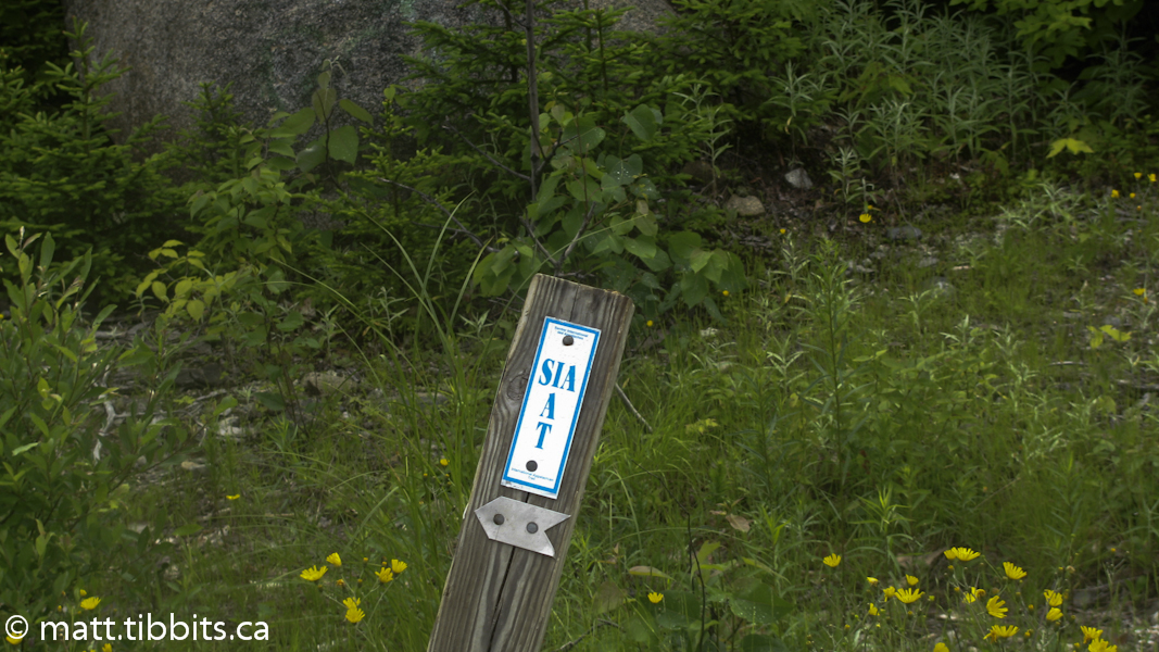
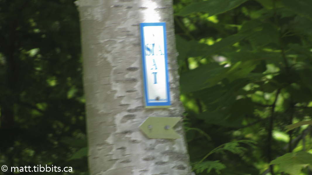
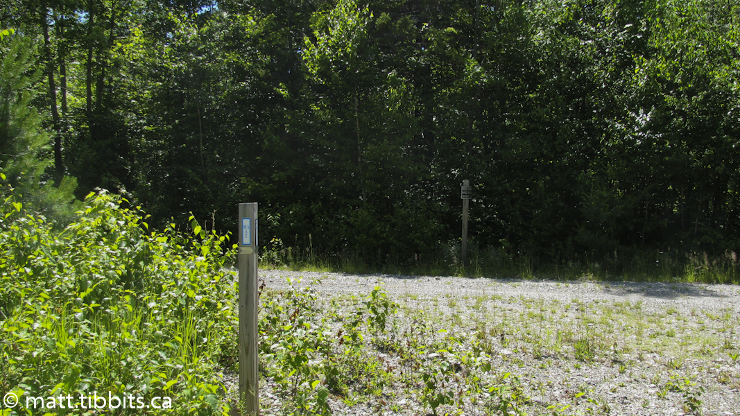
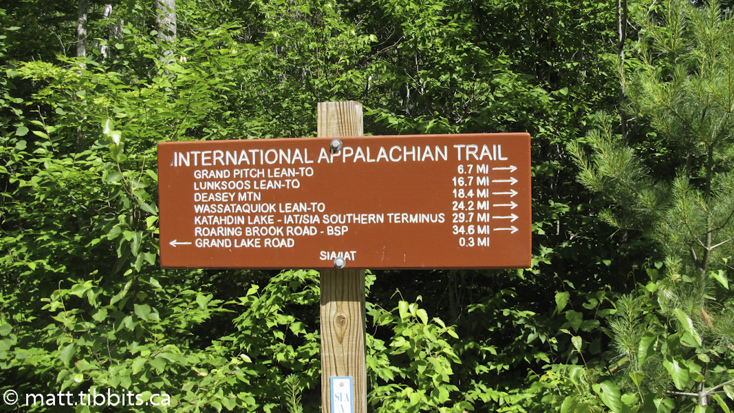
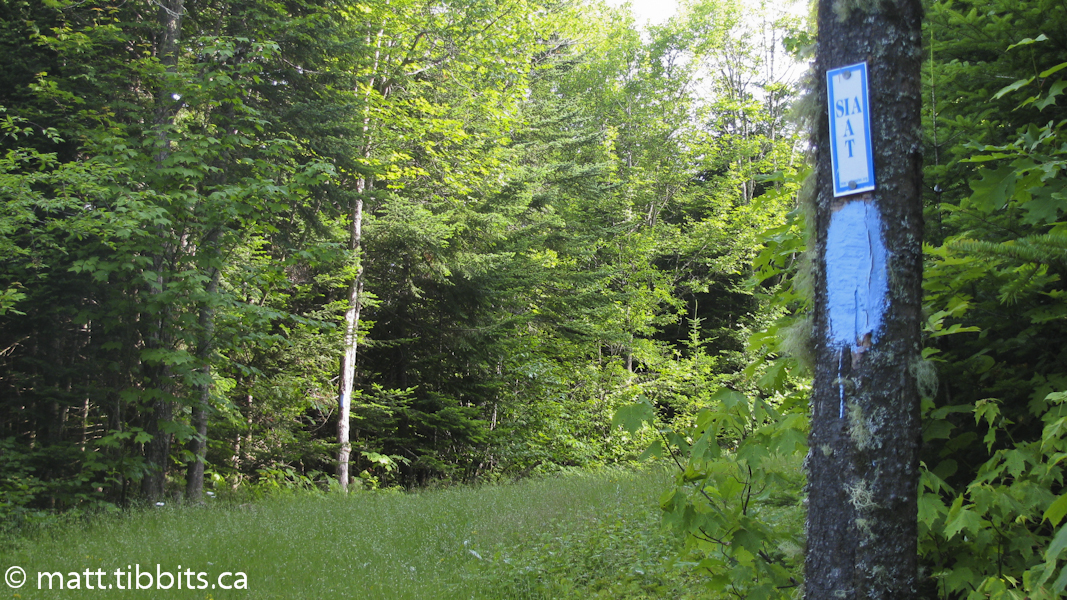
About 2km past the Wilderness Camps, the Katahdin Lake Trail comes out on an old dirt road. Follow to the right where you will come to the exit of Baxter State Park. This is the southern terminus of the IAT. Once you reach this point, the IAT is marked with the IAT/SIA trail markers. Using the Guide from the website along with the trail markers, it is generally very easy to follow the trail. I say “generally” because there are a few tricky spots that I will describe further along.
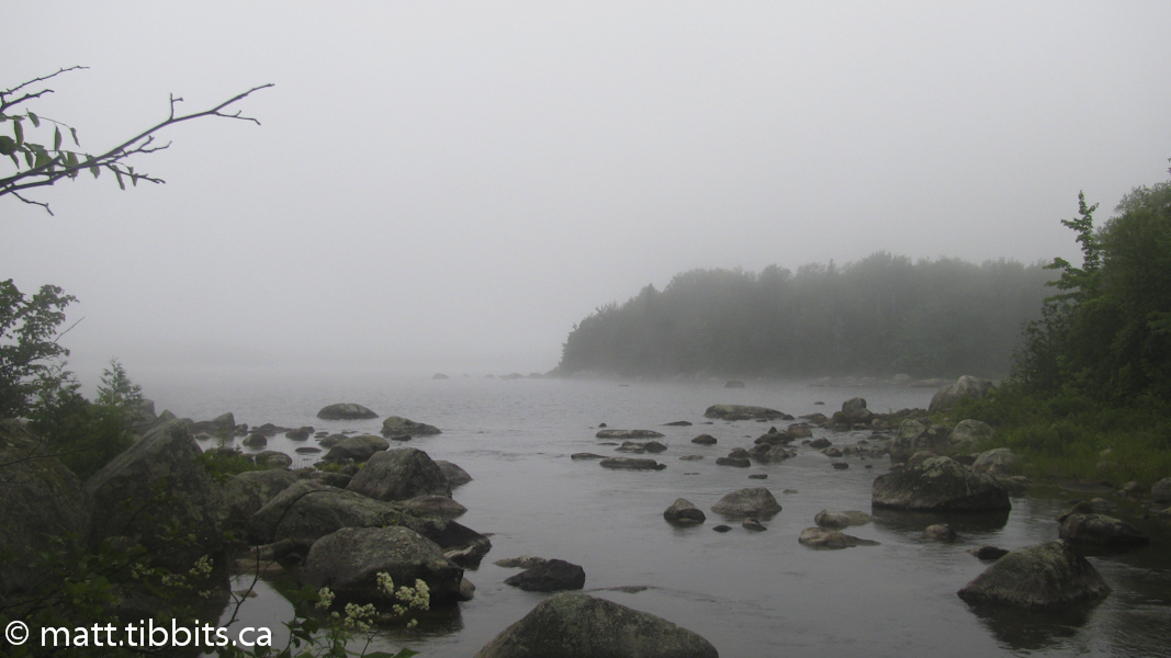
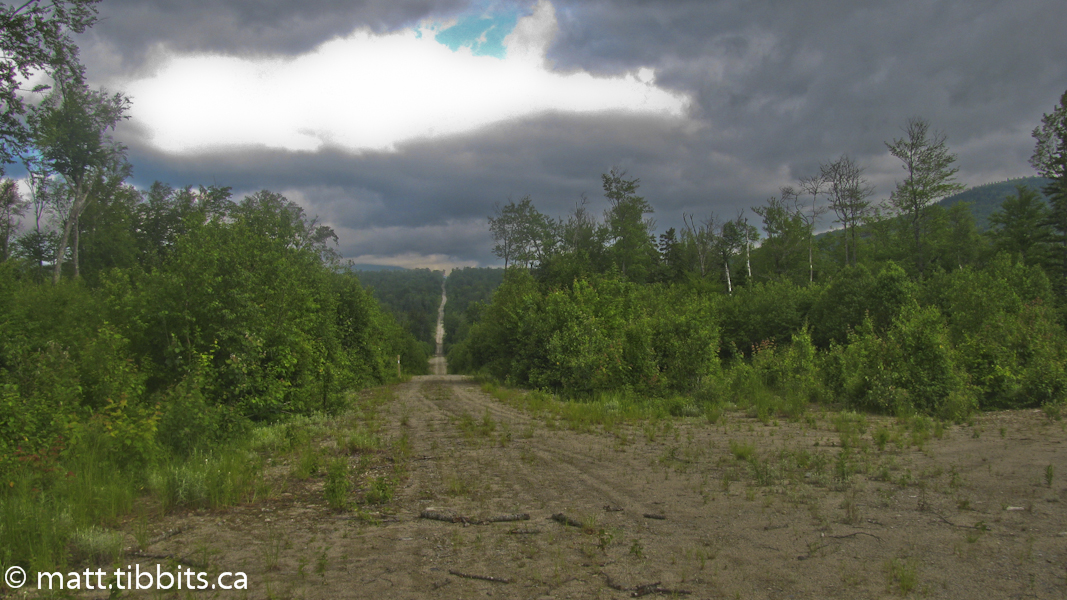
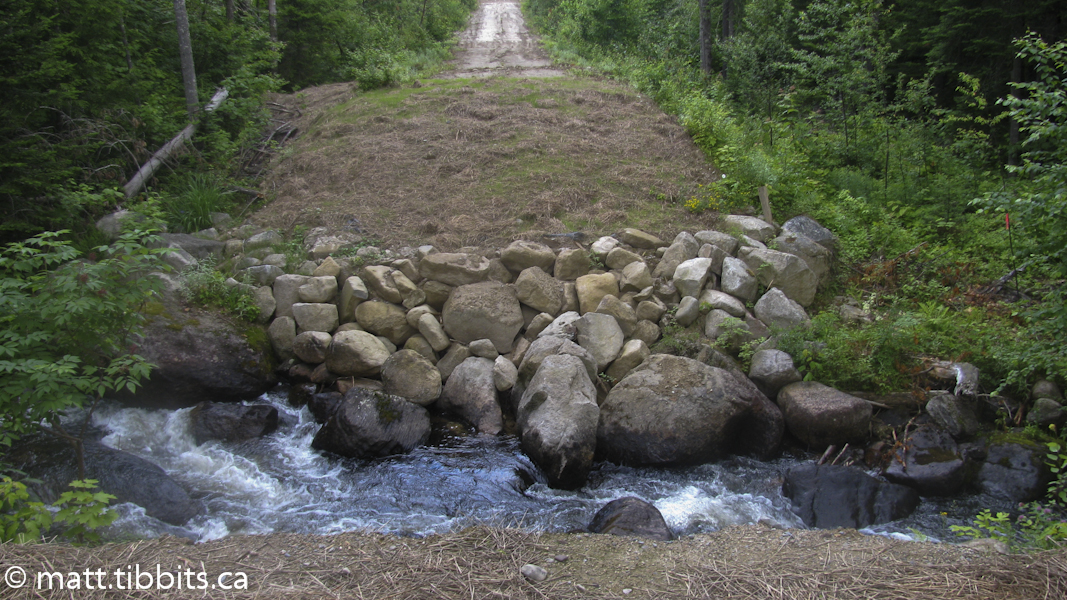
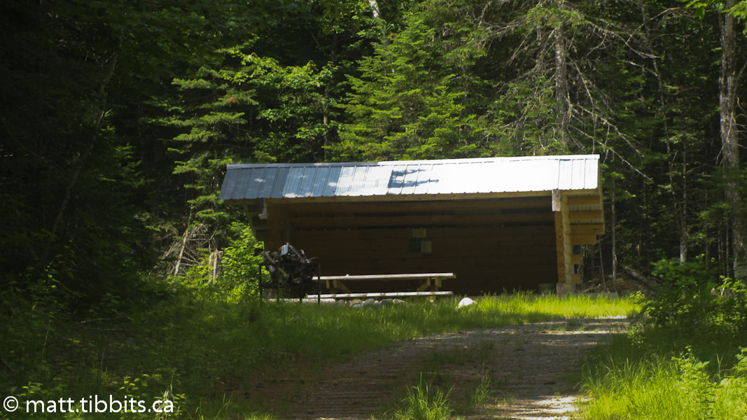
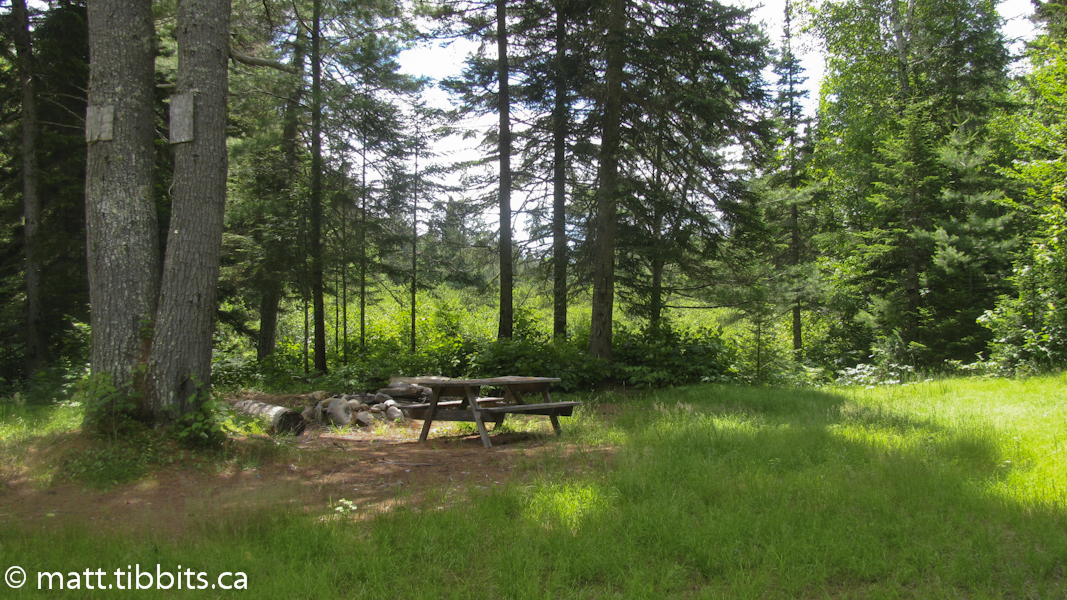
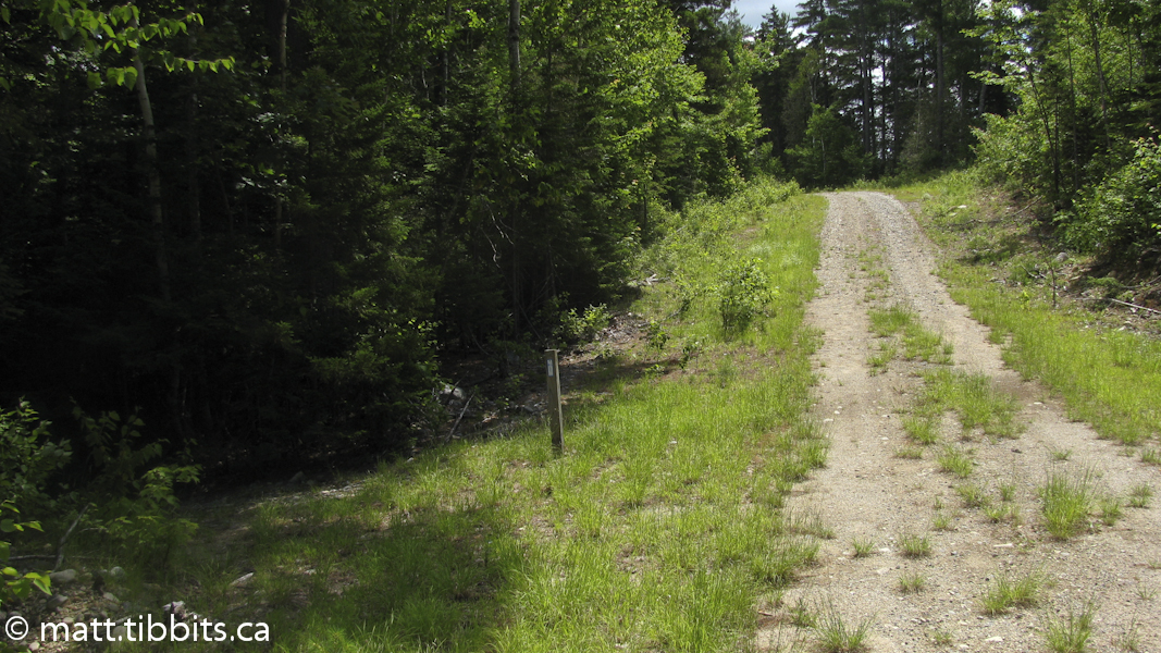
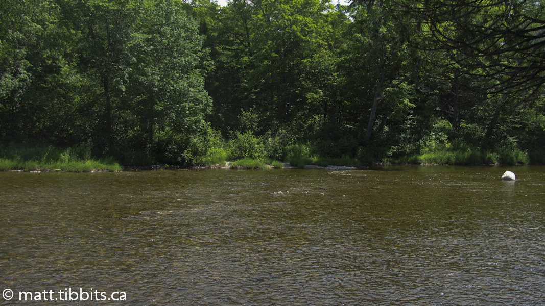
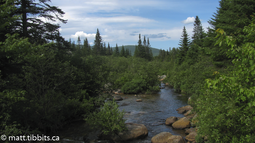
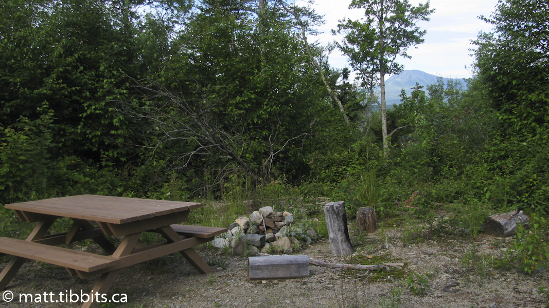
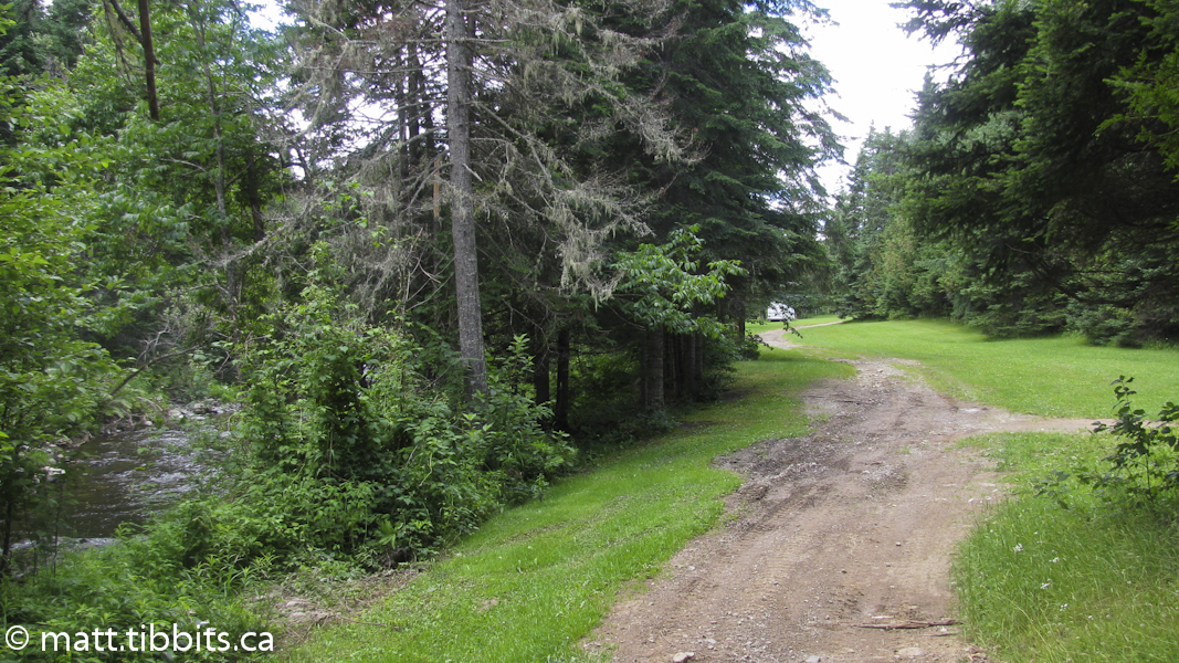
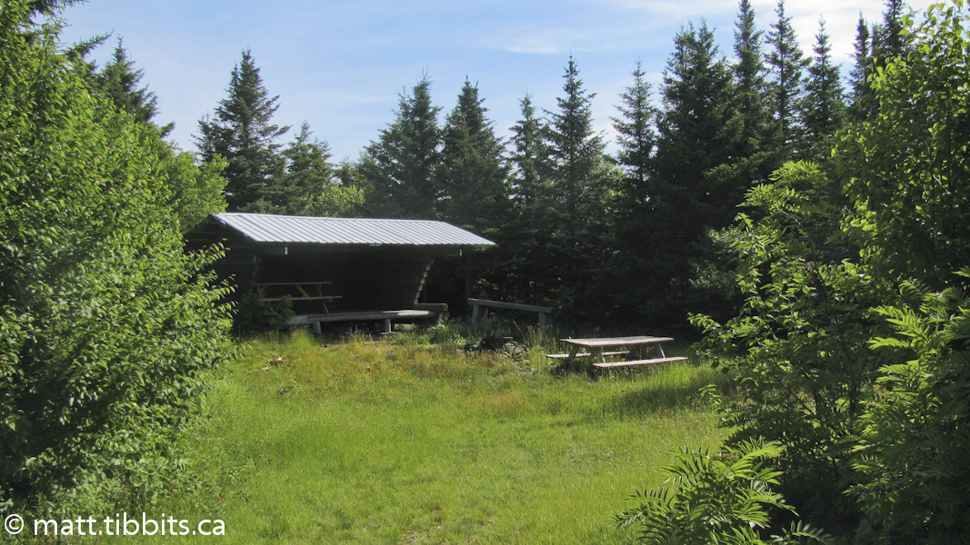
The trail from this point follows old gravel roads that skirt the western side of Barnard Mountain and then pass by the Wassataquoik Lean-to. The lean-tos on the trail are all in good condition with a fire pit and picnic table at all of them. From the lean-to it is a short distance to the ford over the Wassataquoik Stream. The stream is pretty rocky, but was also fairly shallow. I could see how this would be a difficult, if not impossible, crossing early in the year when the water is high.
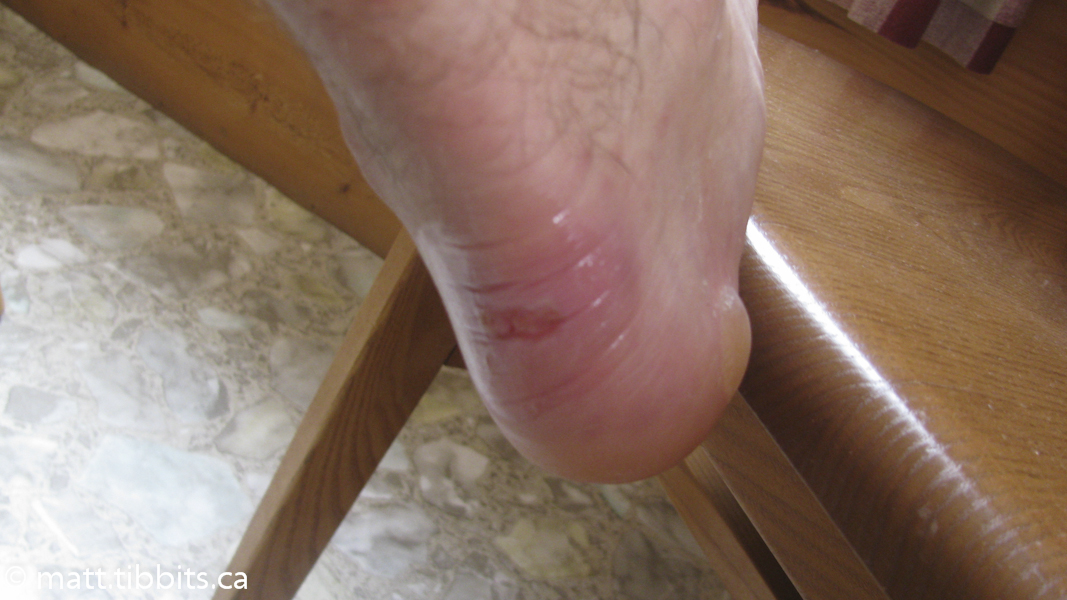
After crossing the stream, I stopped to dry and bandage my aching, blistered feet and eat lunch. I left the spot of the stream crossing around 12:30pm. The trail follows the stream south at this point before branching off to summit Deasey Mtn. Where the trail leaves the edge of the Wassataquoik there is another stream crossing. There was definitely some cursing involved here as I had to remove my boots, wade the stream in my freshly bandaged feet, and then stop again to dry, and re-bandage them.
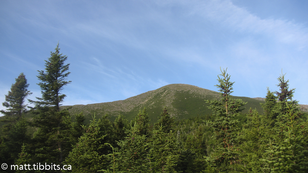
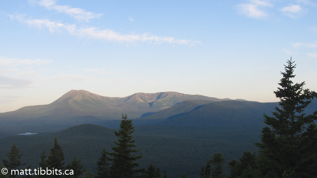
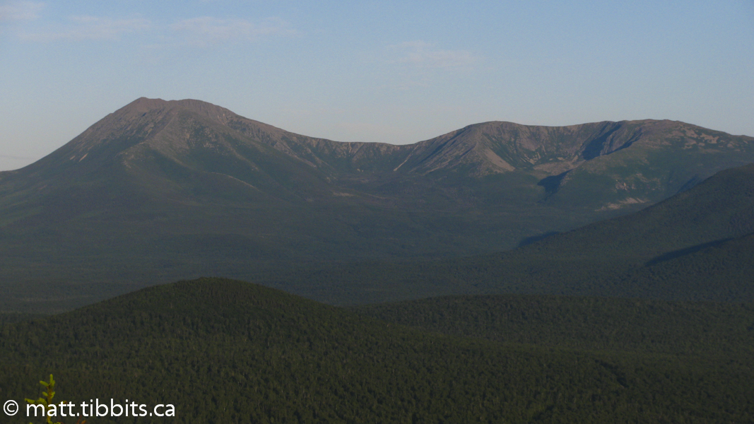
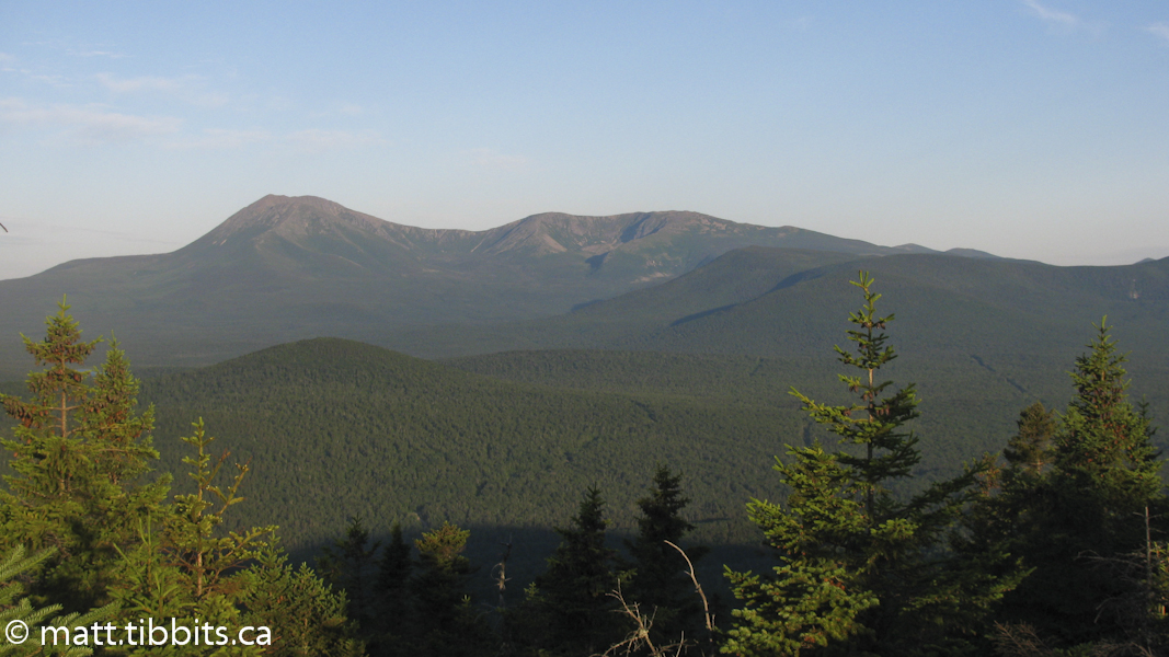
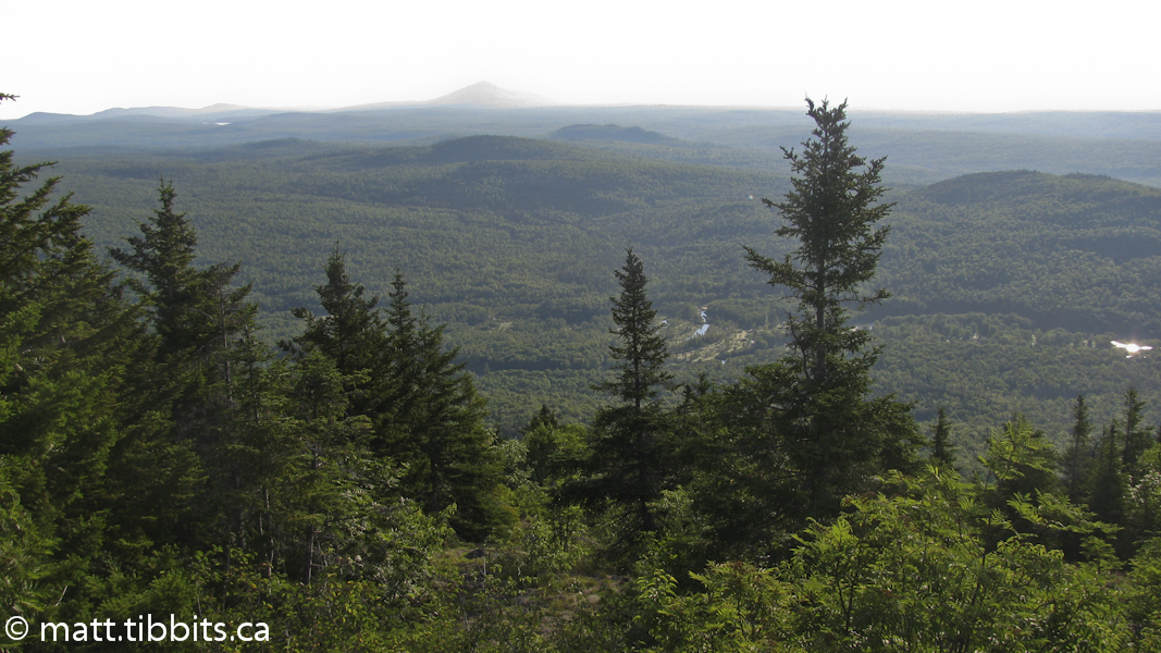
The trail follows a few old roads before heading into an old growth forest where it climbs the north-eastern side of Deasey Mtn. Although not nearly the height of Katahdin, Deasey makes you work for the summit. You pass by an old Fire Warden’s cabin and then it is about 1.5 km straight up to the summit, and I do mean straight up. Having gone all out on Katahdin the previous day, my legs felt every last inch of this climb.
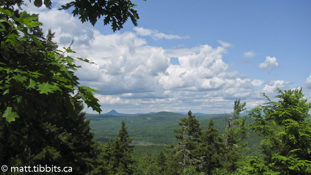
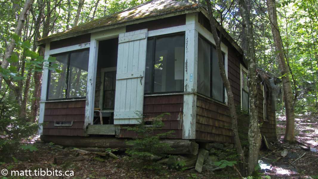
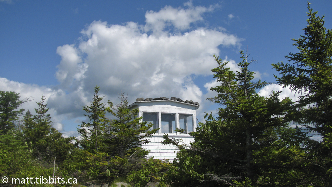
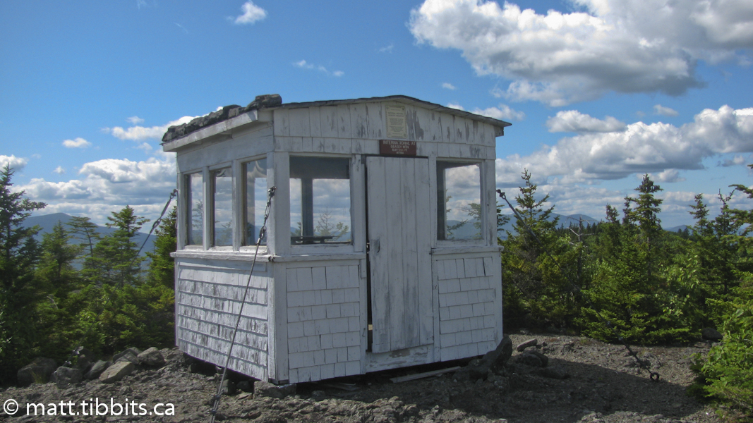
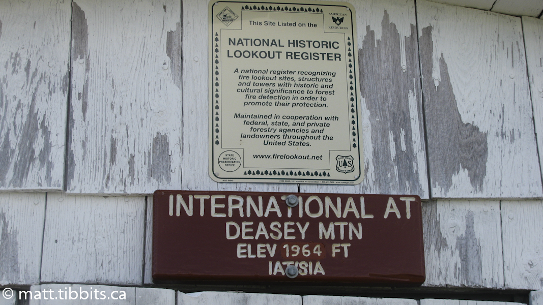
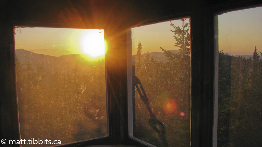
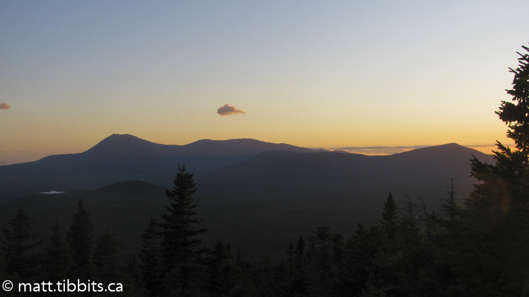
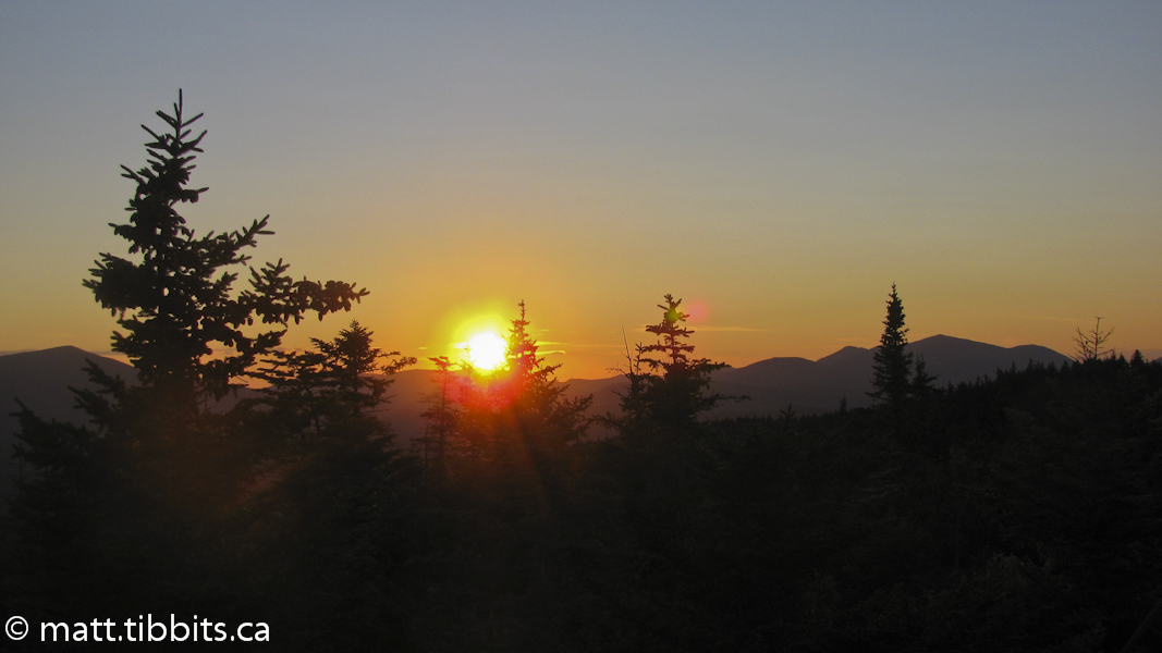
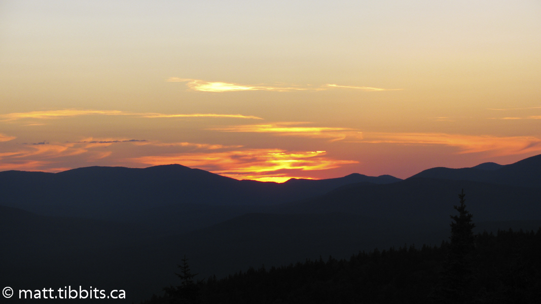
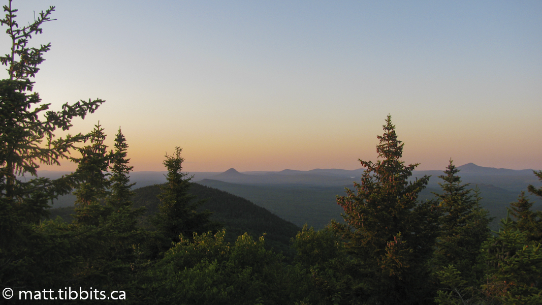
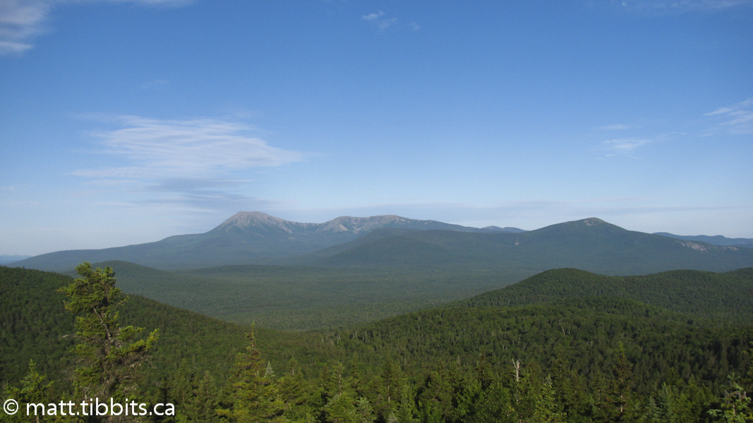
I finally arrived at the summit around 3pm with extremely shaky legs. I was nauseous, dizzy, both heals were ripped to shit, and my Achilles were both tighter than bow strings. I had been planning on trying to reach the trail along the East Branch of the Penobscot River, but would have had another 12 km to go. Feeling as beat as I was, I decided then and there to stay in the little fire lookout cabin right on the summit of Deasey. I threw down my sleeping bag and passed out like a light. I woke up around 5:30pm feeling a bit better. With the evening sun descending over Katahdin in the distance and the 360 degree view from the top of the mountain, it was practically impossible to feel bad. I had a good lunch and did some stretching to ease the pain in my aching legs. I was feeling better but with the pain in my Achilles I was worried about how I was going to make out the next day. Either way I had about 30 km to Matagammon gate and no choice but to hike my way out of the wilderness.
In retrospect I am glad that I stayed in the fire cabin. It was probably one of the highlights of my trip. The sunset was one of those so beautiful that it hurts to look at. There is a remarkable peace there that for some reason is not so easy to find in everyday life.
Total mileage for day 3: 19.5km (12mi)
Day 4 – Deasey Mtn. to Matagammon Wilderness Campground
I woke up early on Sunday, July 10, and left the summit of Deasey around 5:40am. With a good nights sleep, fresh bandages, and 3 pairs of socks I was feeling quite a bit better and ready to bang out 30 km. I was determined that I wasn’t going to stop until I reached the Matagammon Campground, and looking forward to a shower and a cold can of Coke before the day ended.
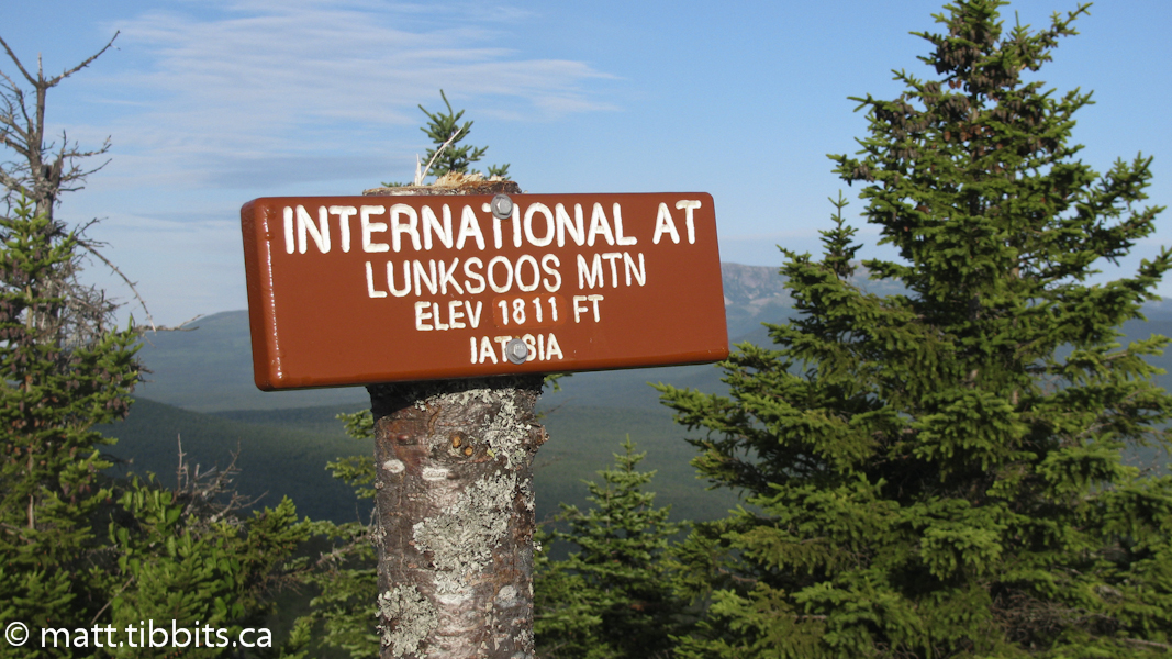
The trail led down Deasey and then back up Mt. Lunksoos right beside. It was a bit of a climb, but not as bad as the climb up Deasey. I summited around 6:30am. The trail then led down Lunksoos to the Lunksoos lean-to. Just before the lean-to there is a sign for water. If you need water, stop, as this is the water supply for the lean-to and there won’t be any other source closer.
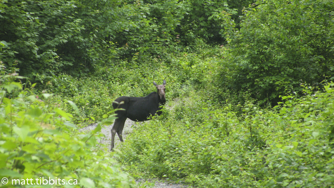
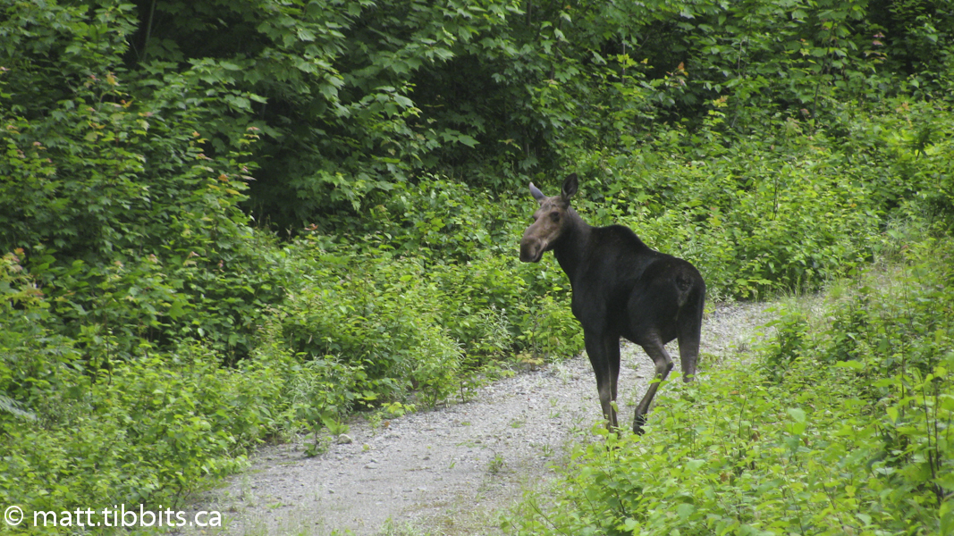
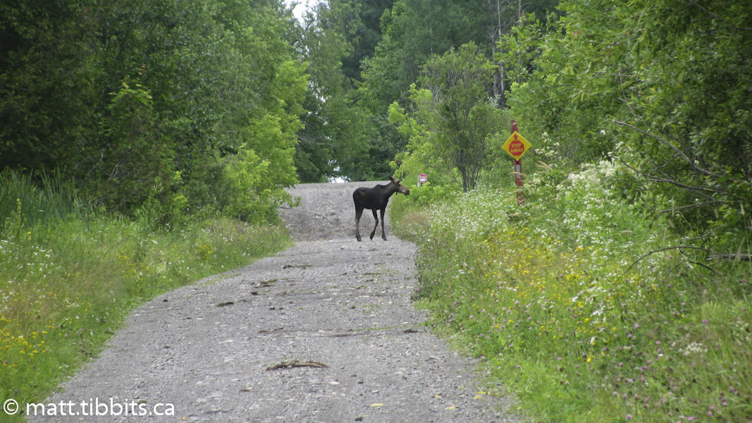
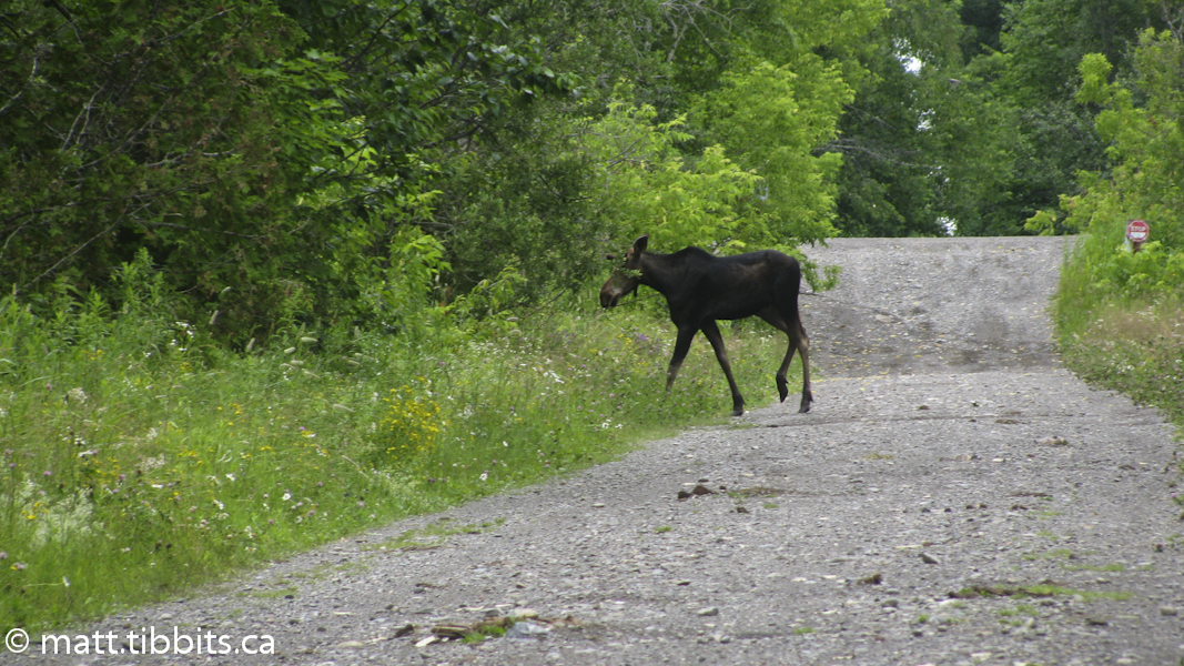
The trail once again follows several old gravel roads at this point, on one of which I saw my first moose. She kind of seemed a little perturbed that I interrupted her breakfast, but eventually gave a bit of snort and moseyed off the trail.
The guide mentions that as you approach the East Branch of the Penobscot there will be a Maine Forestry Service campsite at Little Spring Brook. This is where I was going to stay the day before, and I have to say that I did not see this campsite, or even any sign of it. I was very thankful that I had the idea to stop on Deasey yesterday, because I think I would have been in trouble here if I couldn’t have found the campsite.
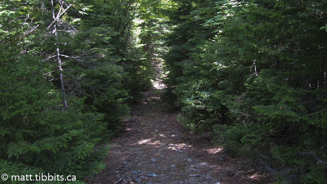
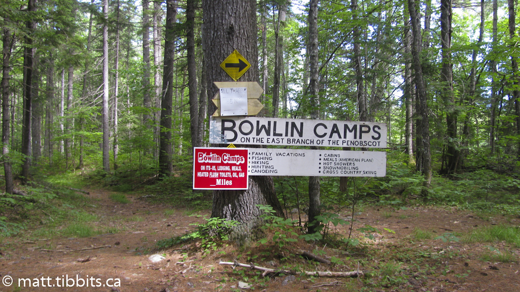
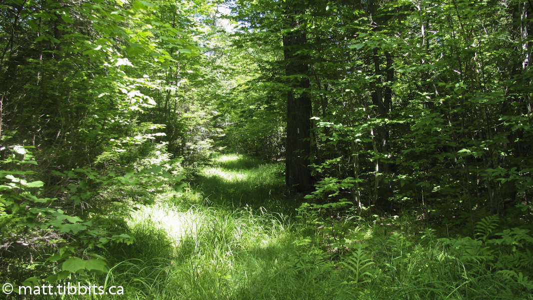
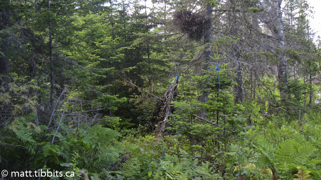
I kept walking and before I knew it I saw a sign for Bowlin Camps, and was much further ahead than I thought I was. That’s always preferable to being much further behind that you think you are. There is a big sign that points to Bowlin Camps by taking the trail to the right where a cable bridge crosses the Penobscot. The IAT, however continues on straight. This is where I hit one of the most miserable sections of trail that I had encountered so far. Basically it is a long, long, LONG section of wet, swampy ground. You have to be sure to step on a rock, or a log, or a clump of grass. Otherwise, you will be sinking into a wet, stinking muck hole. Oh, and all this while being attacked by mosquitoes large enough to carry away a Volkswagen Rabbit. After a little grumbling, some complaining, and much cursing, I came out at the Grand Pitch lean-to on the Penobscot.
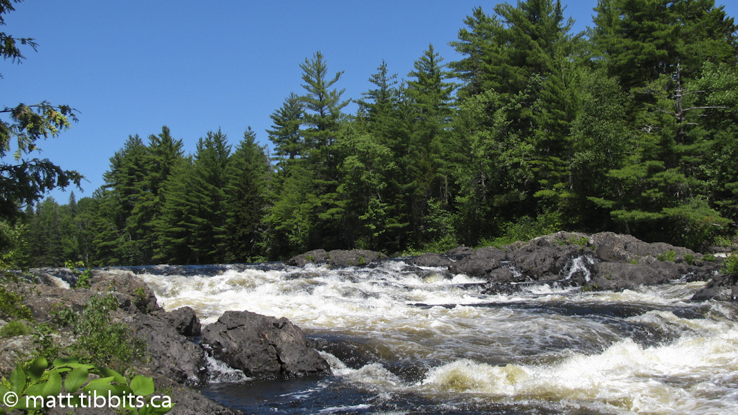
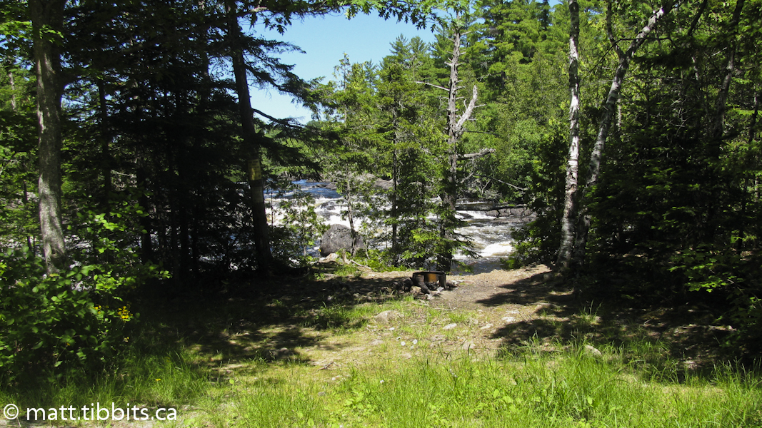
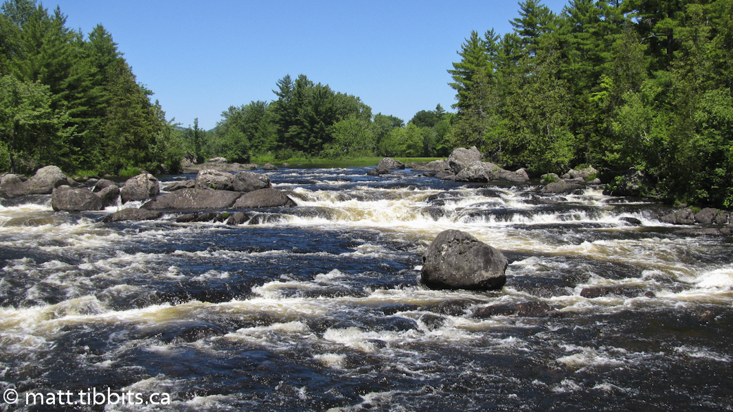
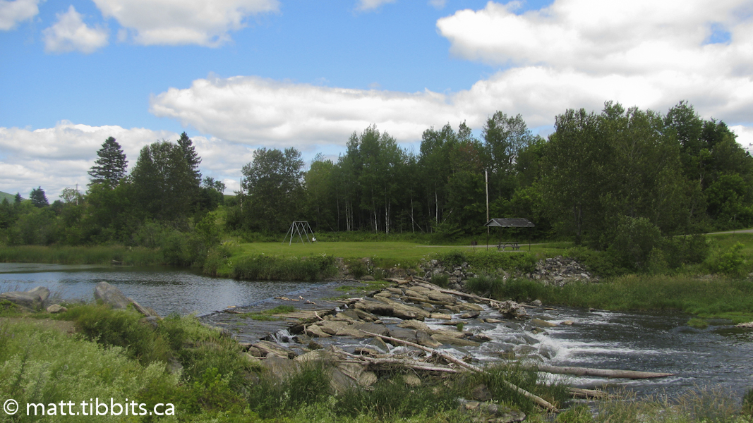
After a much needed break and a lunch, it was time to hit the trail again around 11am. The trail follows the East Branch quite closely here with some beautiful rapids along the way. There are also 3 very agreeable MFS campsites here along the river. I thought it was all smooth sailing from here on out, with an estimated 11 km to go.
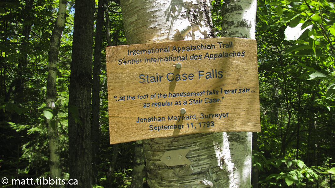
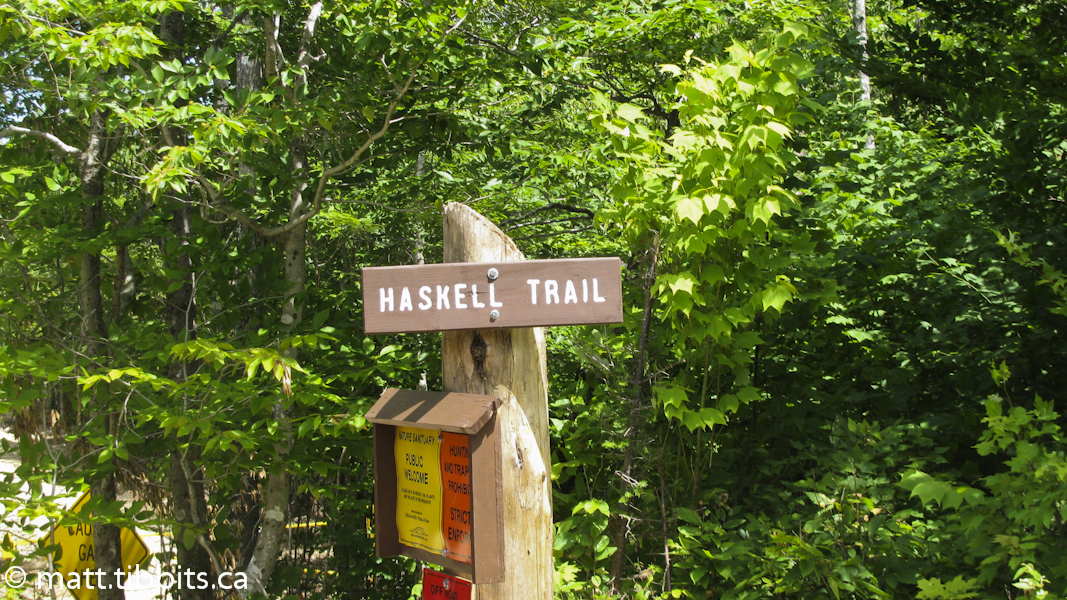
This is where I hit a bit of a snag as far as the trail markings and description go. You reach a spot on the trail where there is a side trail to Stair Falls. There is an IAT/SIA marker on a tree at the entrance to the side trail pointing to the left, or north-west, along a gravel road. I followed this road without seeing ANY other trail marker until suddenly I was at a well traveled gravel road. There was a large gate and a sign on the little side road that I had just exited which indicated that I had been on the Haskell Trail. From my map it appeared that I had come to a junction with the Messer Pond – Orin Falls Road, which I shouldn’t have if I was on the IAT, and still I wasn’t 100 percent sure of that. I backtracked all the way to the Stair Falls side trail, still without seeing any sign of the IAT. I then turned and started back towards Messer Pond Road, looking very closely for an IAT sign on the right. There are none.
This walking back and forth in the heat of the day was killing me. As I mentioned, I was pretty sure that I was on the Messer Pond – Orin Falls Road and that I needed to follow this road north, so I gave up trying to find the trail and started walking. My feet were killing me. The heat of the high-noon sun was beating down hard and I was fucking PISSED! I was in a dangerous spot where the trail was no longer marked, I was weak from the heat and from already hiking about 23 km, I had just hiked approximately an extra 4 km looking for the trail, and I wasn’t even 100 percent sure that I was on the right path. Thankfully a truck came a long and the driver was able to confirm that I was on the road that I thought I was.
I was a bit disappointed to not follow the actual trail the whole way, but there was nothing to do but put my head down and keep putting one foot in front of the other. After a bit I came to a little stream where I was able to dunk my head and get some cool water, which helped to keep me from over-heating. Eventually I came to a spot where the trail came out on the right to join the road that I was on. This was where I had been supposed to come out. I was back on the trail, and knew I had to be getting close. Before long I came out onto a paved road, Grand Lake Road. I followed it to the right, over a slight rise, and there was never a more beautiful site than the bridge over the Penobscot and the Matagammon Wilderness Campground.

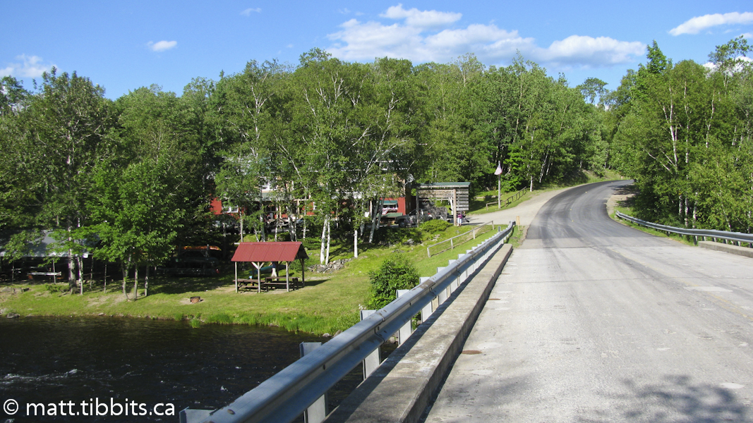
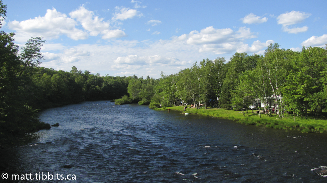
The Matagammon Wilderness Campground is definitely a spot I would like to return to. Right on the river, they have very lovely sites where you can enjoy fishing, canoeing, kayaking, etc. The lady working at the counter was kind enough to find me a site close to washrooms and showers so I didn’t have to hobble to far. I was finally able to enjoy that can of Coke, get cleaned up, and rest my weary feet. The lady at the cash even let me use her phone to check in with family members so that they would know that I was ok.
The last part of the day was very physically and mentally taxing, what with the search for the trail and the extra mileage that ensued. I wasn’t necessarily back in civilization, but I was definitely out of the wilderness. Having a beautiful spot on the river like I did with a nice breeze, a view, and no goddamned mosquitoes or black flies was like paradise. These things helped me to recover and prepare to keep going the next day.
Total mileage day 4: 35km
Day 5 – Matagammon Wilderness to Shin Pond
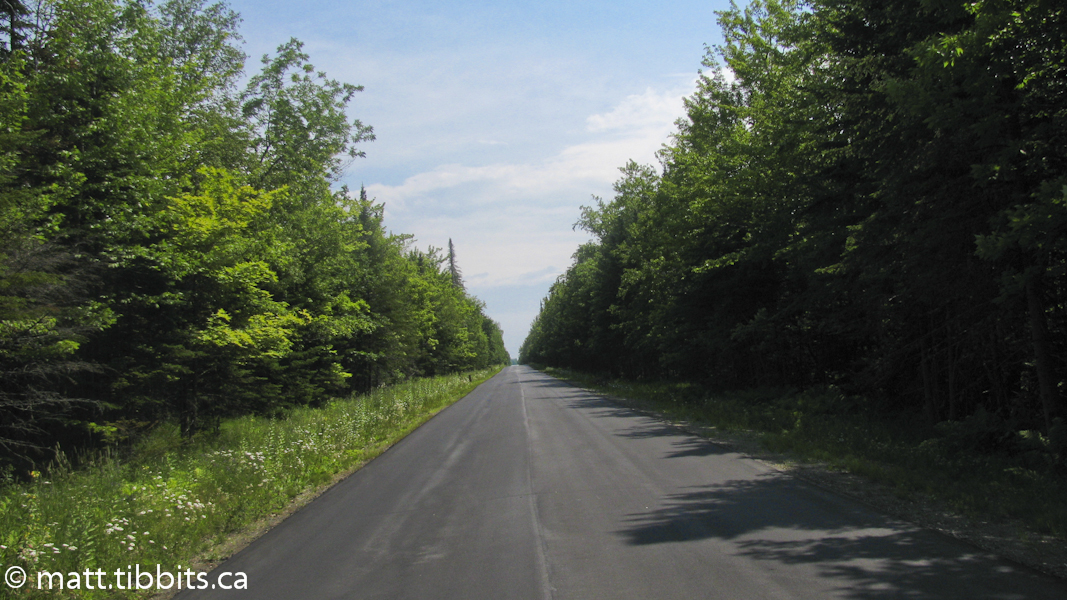
Monday, July 11, was a planned “easy day” with only 22 km of road walking to the next campsite. The pain of the day before seemed to have receded a bit, and I was hoping that the shorter distance today would help. After an indescribably delicious, breakfast sandwich at Matagammon Wilderness Campground, I hit the road around 8:45am. With the pain in my feet I was tempted to hitch, but that is cheating, or so “they” say, so I ignored the temptation and started walking.
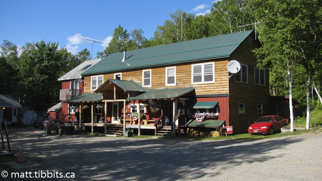
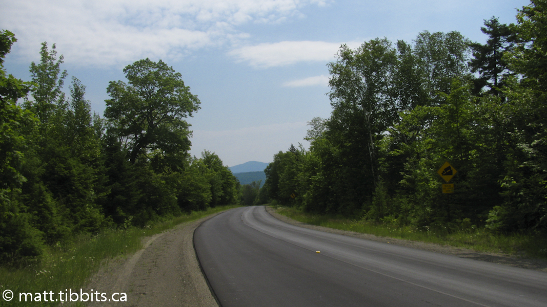
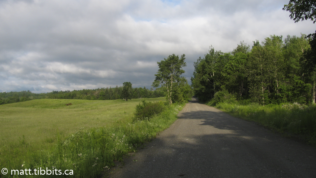
This is a long, long section of road that goes on for what seems like forever, with very little in the way of scenery to serve as a distraction. I walked a hard 2.5 hours before stopping to take a break. Eventually I was able to see Mt. Chase in the distance. Around 1pm a guy named Ray stopped to ask me directions. Me! I was the last person to ask for directions, however I was able to tell him that he was going in the wrong direction. Pretty easy really, seeing as how there was absolutely nothing behind me except Matagammon Campground and Baxter State Park. He turned around and then offered me a lift, which I was happy to take at that point. It turned out that I was only about 2km away from my destination: Shin Pond Village in the town of Mt. Chase, ME.
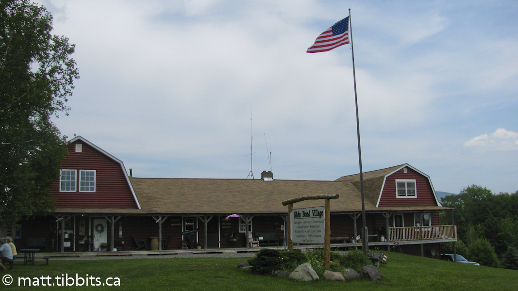
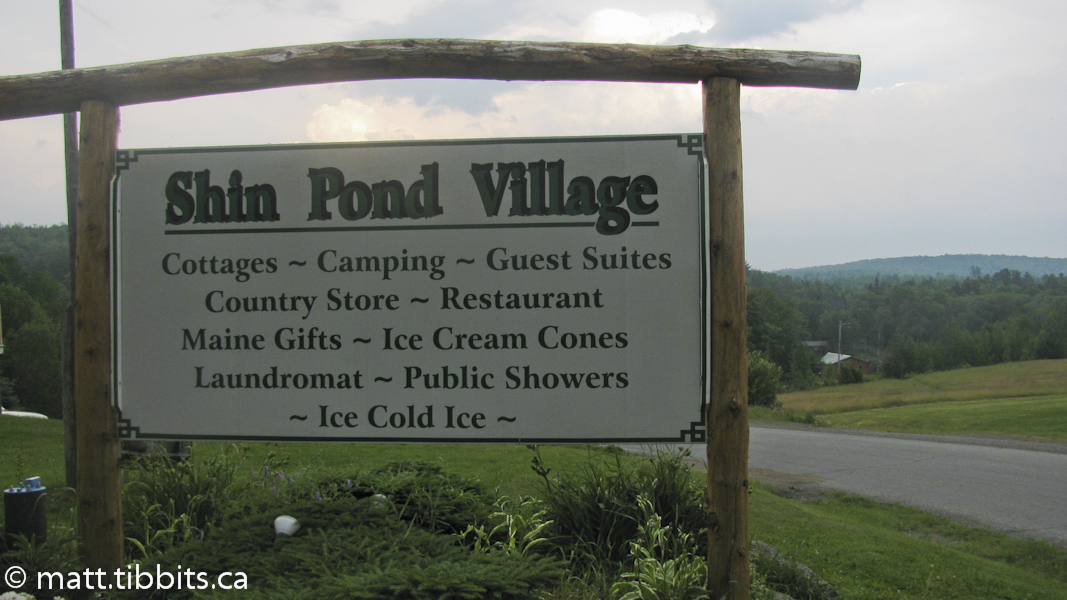
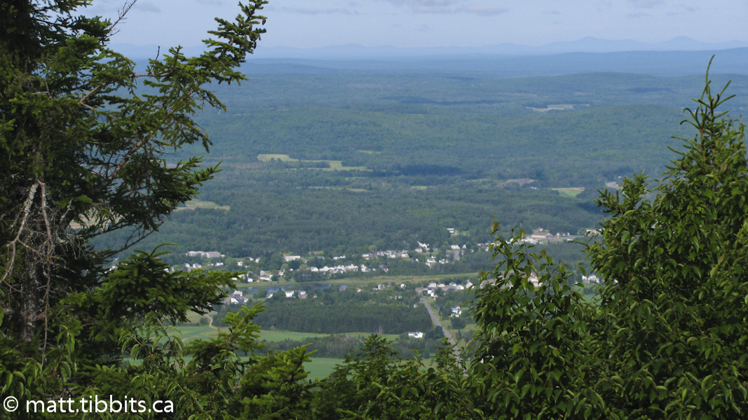
This is another gorgeous spot with Mt. Chase in the distance and Upper and Lower Shin Pond in the valley. In Maine a lake and a pond are apparently the same thing. Upper Shin wasn’t visable, but Lower Shin Pond was clearly not a little pond, but actually a lake with lots of cabins and vacationers. This little bit of info was passed on to me by a local I met named Rich Cormier, whose folks were from Caraquet, in my home province of NB.
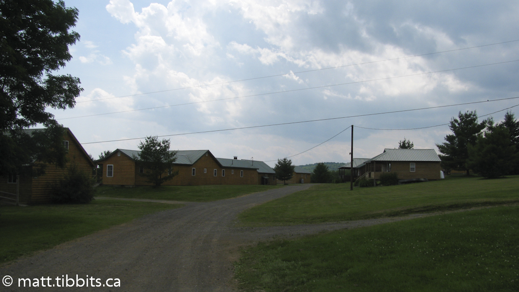
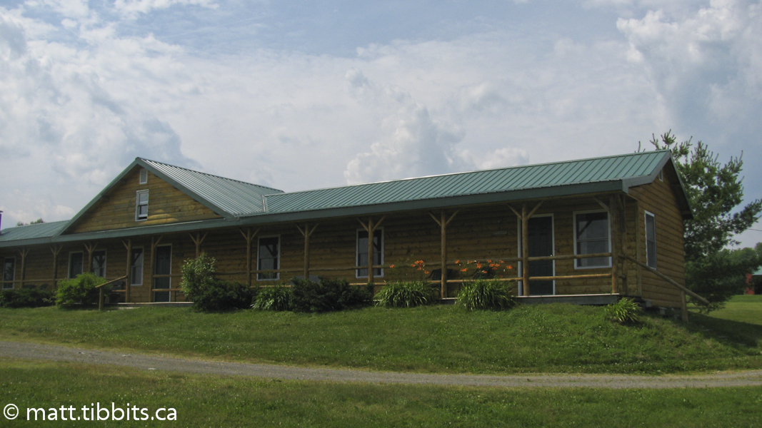
I initially registered for a campsite and then hobbled out to find that it was back in the woods with no sun at all. I hobbled back to the store to change the site, and then limped back to find that this new one was in the middle of a field without any shade. I made my way back to the store again and on the way decided to spring for one of their cabins, and was I ever glad I did.
The cabin was absolutely beautiful with a real bed and shower! And the shower didn’t take quarters! This was hiking in style. It was even nicer when there was an absolute deluge of a thundershower that night and all I had to worry about was rolling over and going back to sleep.
Total mileage day 5: 22km
Day 6 – Shin Pond to Houlton, ME
I decided here that I was going to speed up the trip a bit. The next section of trail was about 60km of road walking and my feet were in bad shape. Not so much my feet as my heels. My Achilles were getting worse and worse and I was starting to worry that I was going to do some serious damage, especially to the right Achilles that I had hurt way back on Mt. Katahdin. So I decided to do a bit of hitching and try to make Houlton in one day. I know that it is technically against the “rules”, but you know what? It’s my hike, and being so I will do it however way I want to. I did promise myself that I still had to take the roads that the trail followed. So I was still following the IAT all the way, I just wasn’t walking every last miserable step, and a day of rest would hopefully allow my feet to recover enough so that I could finish the hike.
On Tuesday, July 12, I set out around 6:30am on Route 159. Just before the Shin Pond Pub a guy and his wife pulled over in his pickup and asked if I wanted to hop in the back with the dog. I said “yes”, and thought to myself that this was gonna be easy. He drove me all the way out to Route 11, where I started walking with my thumb out.
An hour later, and I was thinking that maybe it wouldn’t be so easy. I ended up walking the whole 8 km section of Rt. 11 to the Town Line Road, with logging trucks blasting by almost non-stop. After making it to the turn-off without being turned into road kill, it was time for a break. I had a bit of a snack and once again slung my pack onto my back. From the looks of this road I wouldn’t be likely to get a lift there either as there seemed to be no traffic at all. However, I no sooner took 3 steps than a car turned onto the road and slowed beside me. I gave them a sad look and they pulled over and asked if I needed a lift.
Turns out they were going all the way to Houlton. I was back to thinking that this had been too easy. This nice couple lives on Rt. 11 and had been helping IAT hikers for years. Their names are Rodney and Ruth Grass, and I was very grateful to them for the lift. She even took the roads that the trail follow so that I could see where I would have had to walk. They pointed out a buffalo farm, and the Mennonite community, and all of the other landmarks along the way. I was in Houlton by 10:30am, having covered about 60km in a few hours, instead of a day and a half. I felt a bit guilty about the drive, but my feet were thanking me.
Total mileage day 6 (walked): 8km
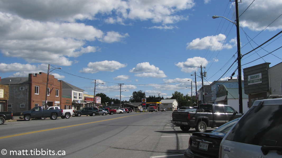
Day 7 – Houlton to Mars Hill, ME
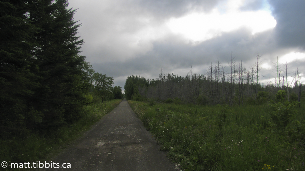
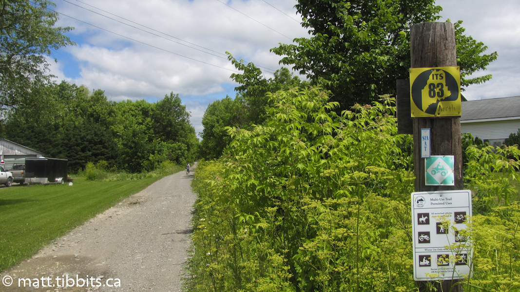
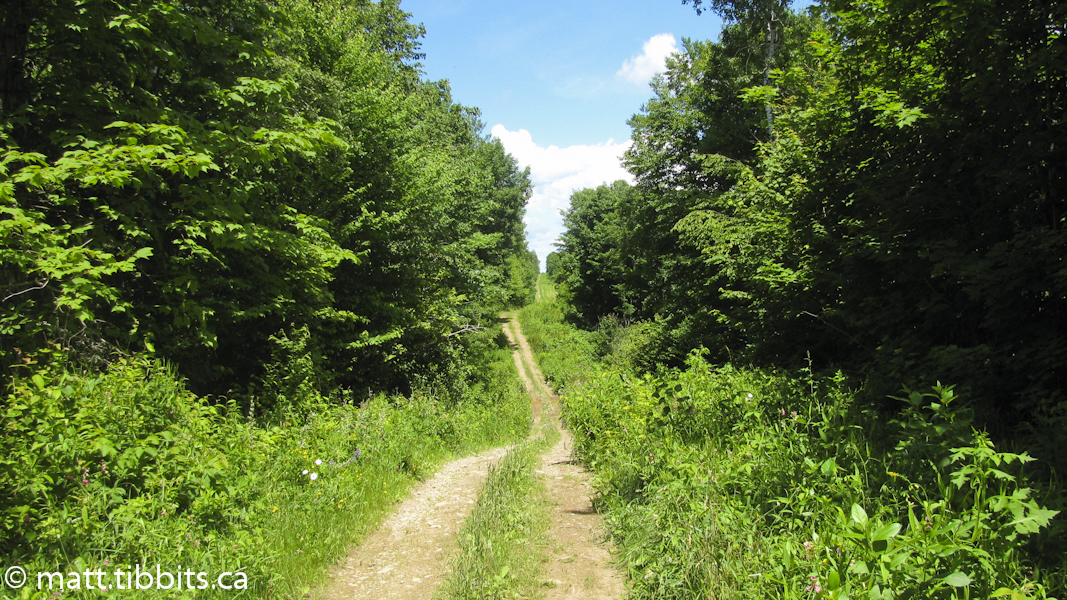
On Wednesday, July 13, I left Houlton around 6:45am and headed north on Route 1 to London Lane, which would take me to the multi-use trail that follows an old railway bed. The turnoff of Route 1 for London Lane is right across from a US Border Patrol station, and there is also a road sign marking London Lane. Turn right from London Lane onto the trail. This trail is mainly used by ATVs, but is well maintained which makes for pretty easy walking.
After about 16 km on the trail you come to Monticello, ME, home of the famous Blue Moose Restaurant. There is a sign and a side trail just before the Monticello Trestle that leads to the Blue Moose. I made it here by 10:30am and decided to stop in for some breakfast. I wasn’t sure whether to go back to the trail or to hike north on Rt. 1, as I have seen both ways described in the guidebook. I asked the folks who run the restaurant and it seemed the easiest way was to follow Rt. 1 to Bridgewater where the trail would cross the highway again. While I was waiting for breakfast they came over and told me that there was a church group in the back and that one of the gentlemen there would give me a ride to Bridgewater.
I have to say that the folks from Maine are some of the nicest people. The whole way along the trail people were nothing but friendly and helpful, which helped to make it a great experience. There is something to be said about the kindness and generosity of small town folks. If only some of that could be transferred over to city folks I think the world would be a better place.
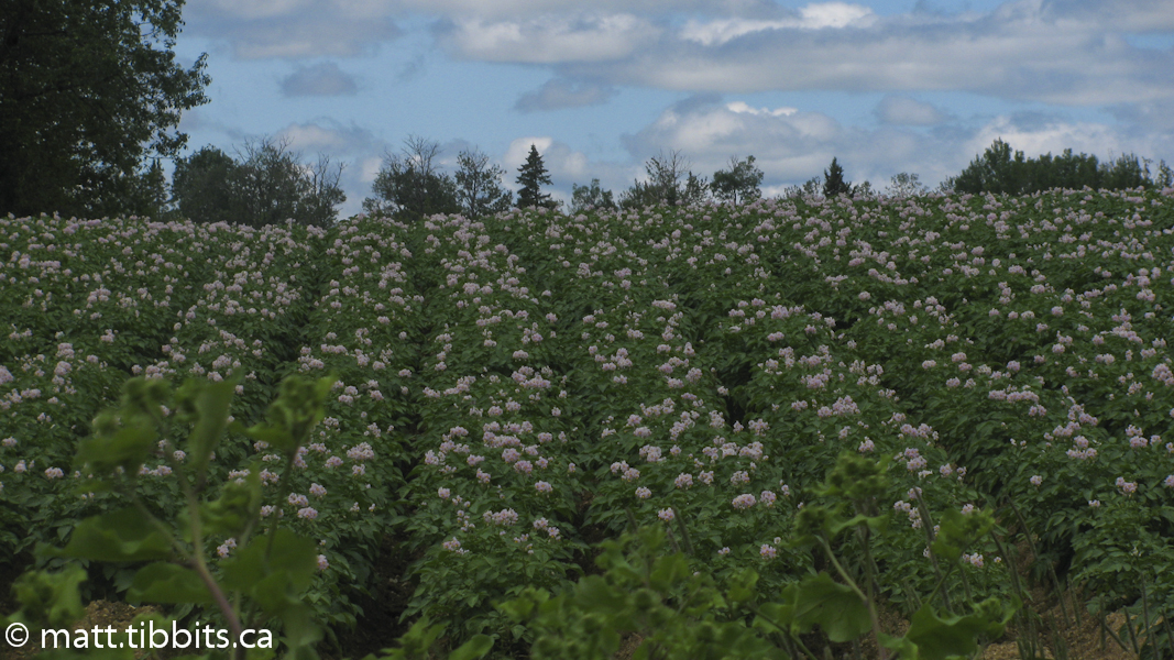
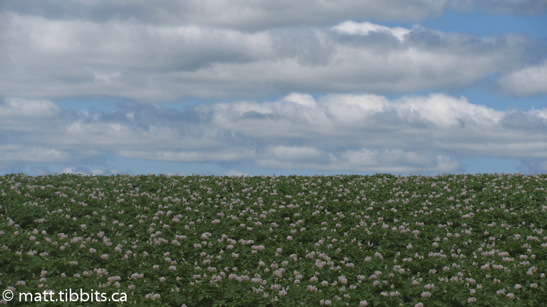
So, after another delicious, mouth-watering breakfast at the Blue Moose I was dropped off in Bridgewater, and struck out on the trail to Mars Hill around 12pm. My feet were hurting again, but I knew I only had another day and a half of hiking after leaving Mars Hill to reach Perth-Andover, NB, the end of the trail. This thought alone was enough to put a spring in my step on the trail to Mars Hill. As well, all of the potato fields along the trail here were a clear sign that I was back in the St. John River Valley… home!
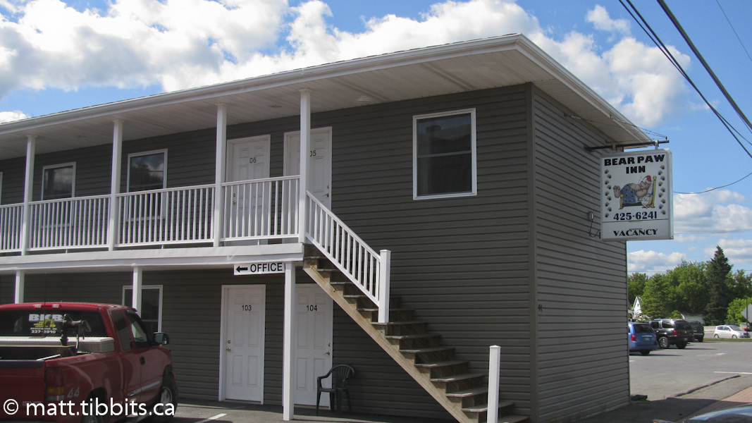
Along the trail to Mars Hill you will cross Bridgewater Corner Road. Continue north to where you will cross Prestile Stream. After crossing the stream there is a side trail on the left that leads to a grassy area where you can camp. Continue on the trail to Mars Hill. I arrived in Mars Hill around 2:30pm and briefly considered heading up the mountain, but decided to take a room instead. I found a spot at the Bear Paw Inn, and I have to say the room had the best shower ever. The water pressure was enough to knock you down, and there was even a bench in the shower! Perfect after another long day of hiking.
Total mileage Day 7 (walked): 30km
Day 8 – Mars Hill, ME to Perth-Andover, NB
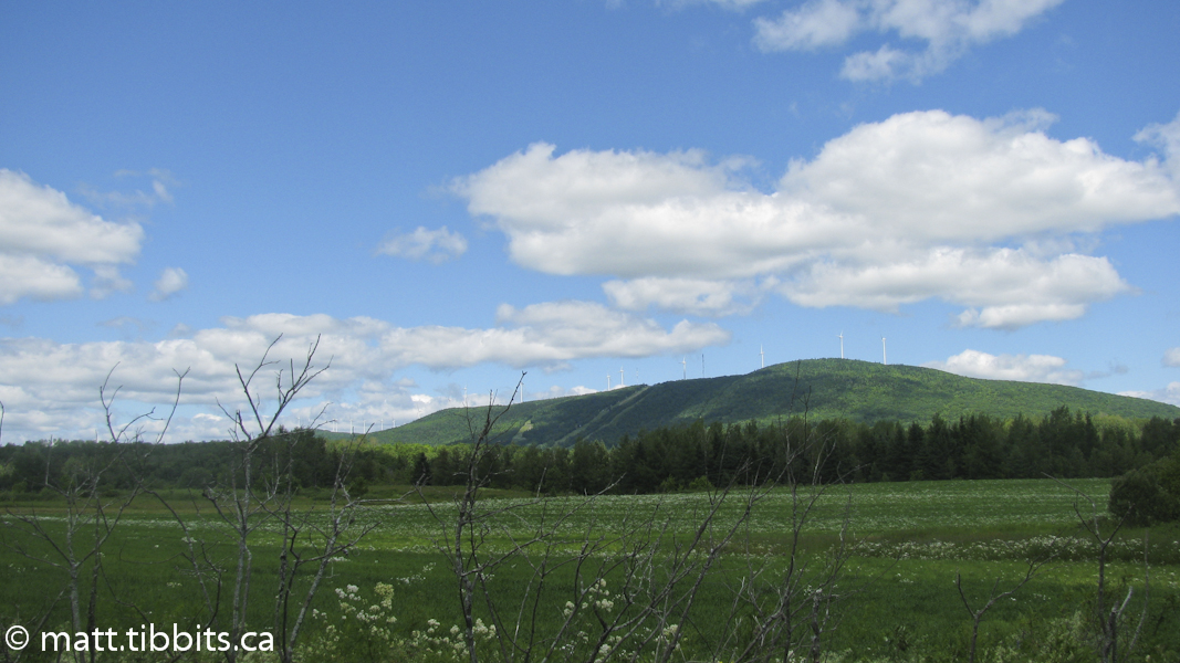
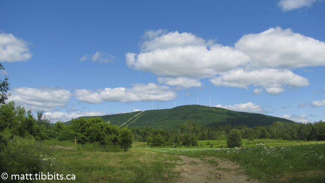
I woke up around 6am on Thursday, July 14, and if I had of known what this day would bring, I would have been on the trail much earlier. As it was, I stopped to get some Subway for breakfast in Mars Hill, and had to wait until they opened at 7am, putting me on the trail at 7:15am. From Mars Hill the trail turns right onto Rt. 1 and crosses the bridge to Boynton Rd. Follow Boynton Rd. to the end and then turn right towards Big Rock Ski Resort on Mars Hill Mountain.
Here, I again take exception to the directions in the guide. They say to “continue past the parking lot and then turn right onto the access road leading up the mountain”. I did this (see photos) and you end up on a road that leads off to the right and NOT up the mountain. I’m still not sure, but what I think they should say is not to “pass the parking lot”, but to actually walk through the parking lot to where the main chair lift comes down to the lodge. There is a trail on the left and one on the right. Take the trail on the right which heads up the mountain. You will pass the top of another small chair lift and continue up the mountain. Halfway up, there will be one IAT/SIA trail marker. At least there is one, but in a place like this where there are literally trails everywhere, I would like to see more descriptive directions and better trail blazing.
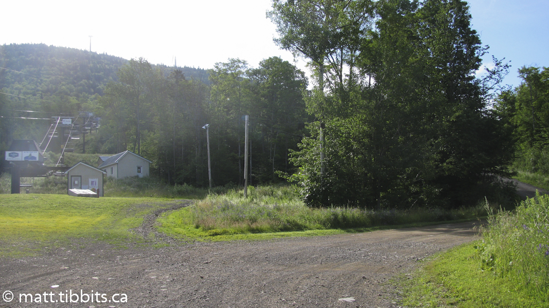
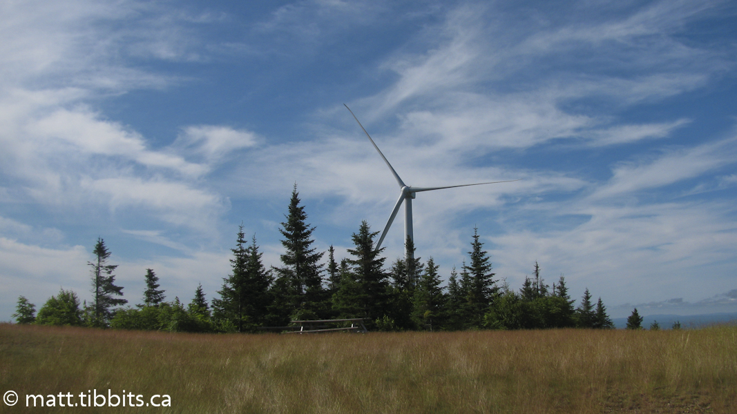
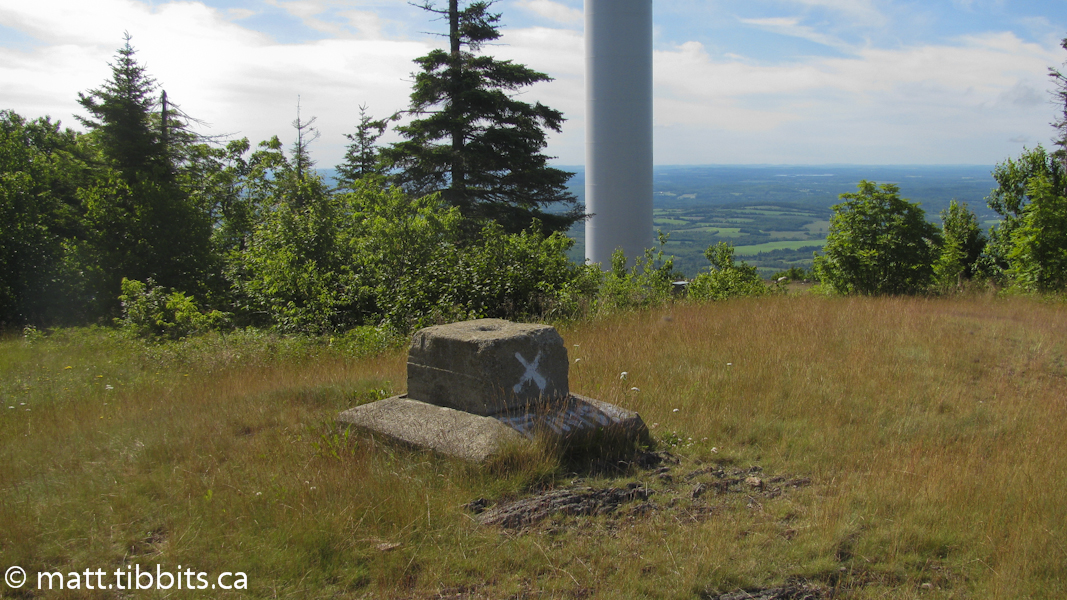
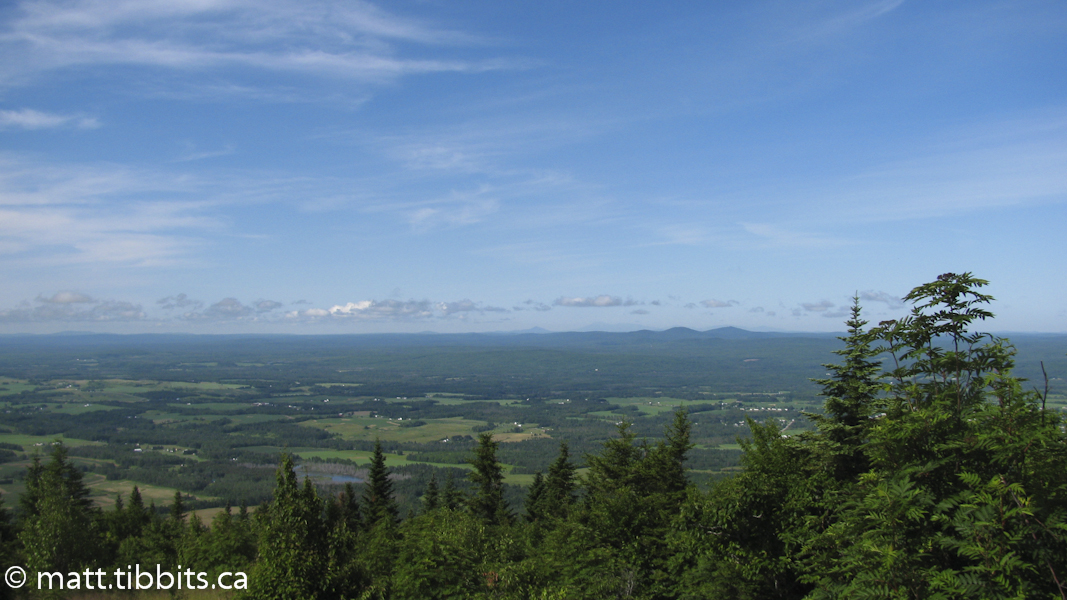
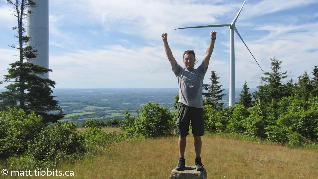
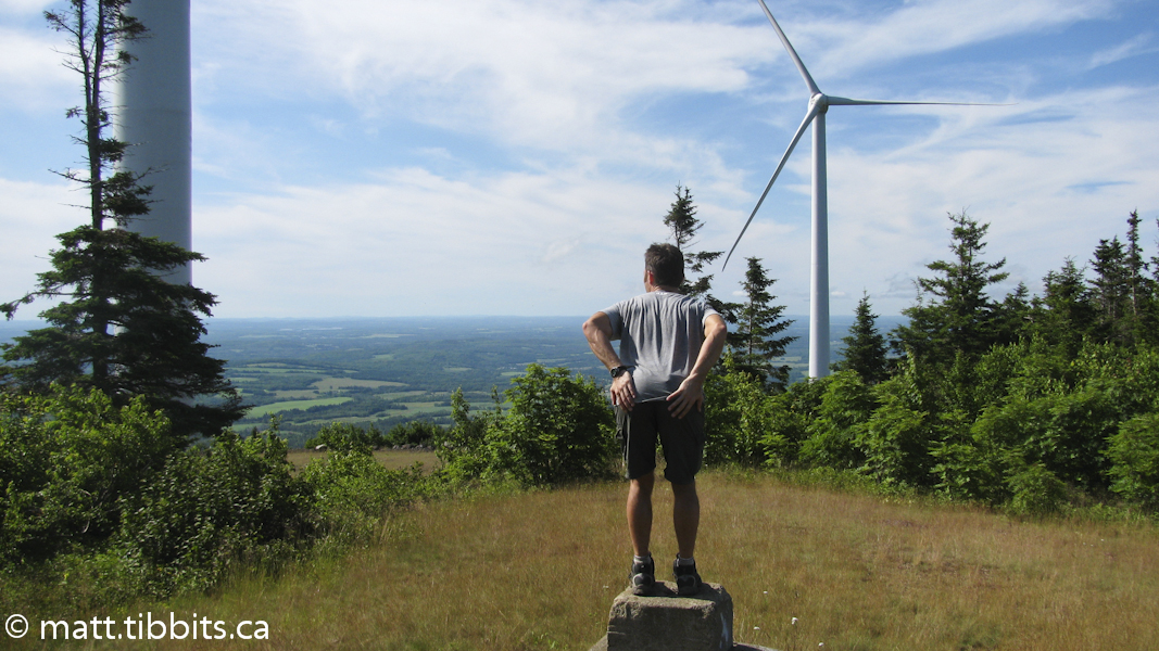
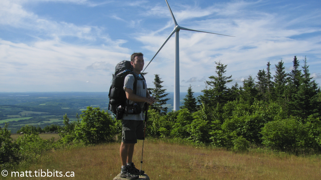
Anyway, after a bit of wandering back and forth at the bottom, I did find my way to the top. If you turn right and follow a small access trail you will come to the lean-to on the south peak, beside tower 27. There is a large grassy area here for camping, and a lean-to off to the side. From here you can see Maine, USA on one side and NB, Canada on the other. I would point out that there isn’t a water source on the mountain, so if you want to camp there for the night be sure to bring enough water when leaving the town of Mars Hill.
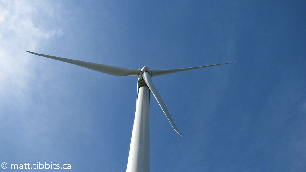
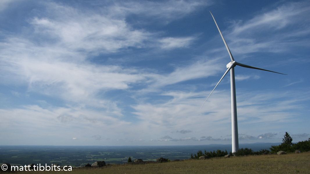
I reached the top around 8:45 and had some breakfast. I left the rest area around 9:20 and followed the Wind Farm access road across the various peaks to the north side of the mountain, where you eventually reach the East Ridge Rd. Another trail note: the guide describes leaving the road at tower 6. There is a small trail that is marked with tape off to the right that leads to a field. Don’t go this way. I found myself pushing through a field of hay and raspberry bushes. The hay wasn’t so bad, but the thorny raspberry bushes left me feeling a bit worse for wear. I’d suggest simply following the Wind Farm road to the end and then turning right on East Ridge Rd.
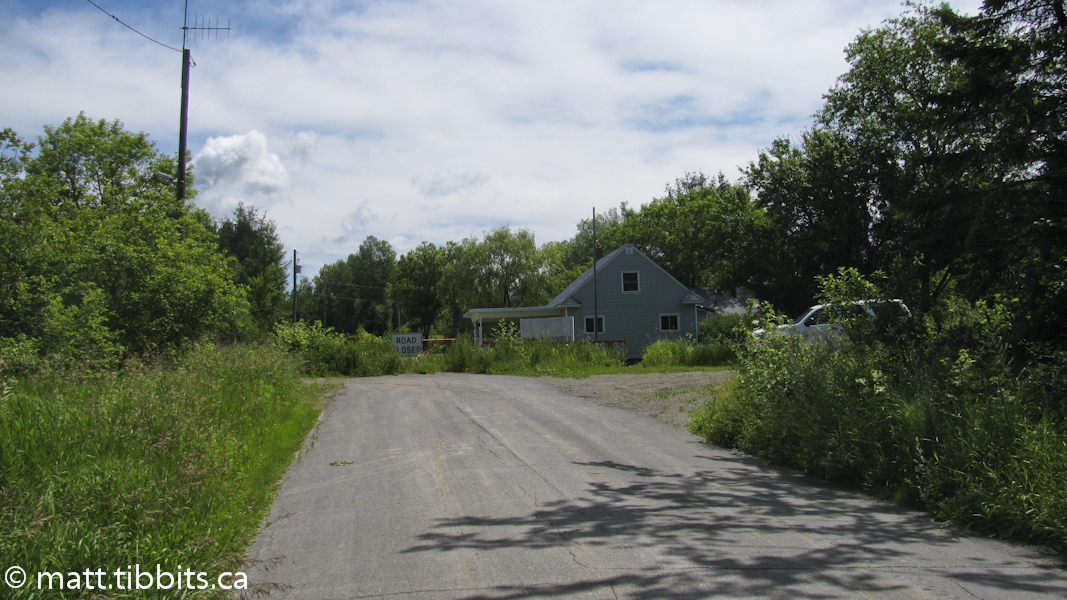
Follow the East Ridge Rd. about 2 km to the border. You come to an old border guard shack and turn left onto the border trail. I started out on the Border Trail around 11:45am with the plan to stop in Fort Fairfield, ME for the evening. That would leave me about 16 km to hike into Perth the next morning.
Before hiking the border trail, it is important to contact the US Border Patrol and let them know that you will be there. The guide recommends this, as do I. If you don’t, you will probably be stopped by border agents. I made sure to contact them from Mars Hill and didn’t have any problems hiking the trail.
I didn’t have problems with US Border Patrol I should say. The trail itself was one giant problem. Somehow I imagined a nice, easy ATV trail, similar to the trail between Houlton and Mars Hill. That, my friends, is most definitively not the case. First of all, this is the St. John River Valley. There is hardly a flat section of land anywhere, and here is no exception. The trail goes up, keeps going up, and then goes up some more. Then it goes down a bit. Then it goes up again. The entire trail is nothing but uphill and downhill walking.
On a brighter note, it is kind of neat that you are hiking on the boundary between the two countries. This really brings the whole “international” aspect of the trail into view.
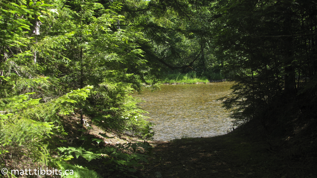
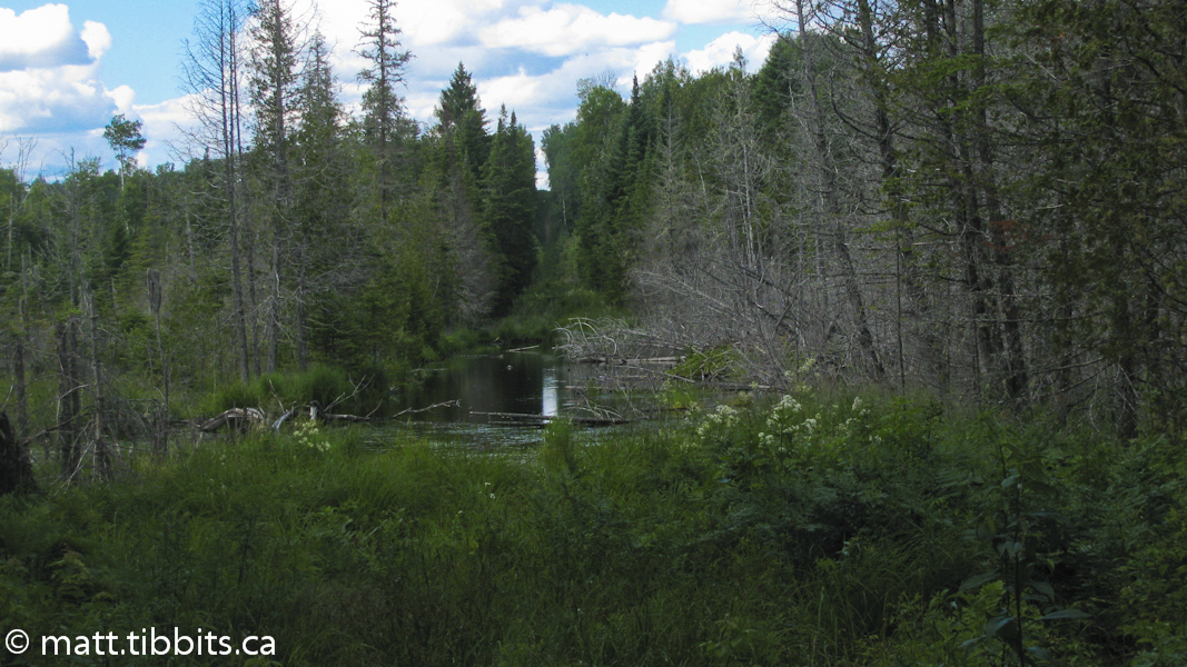
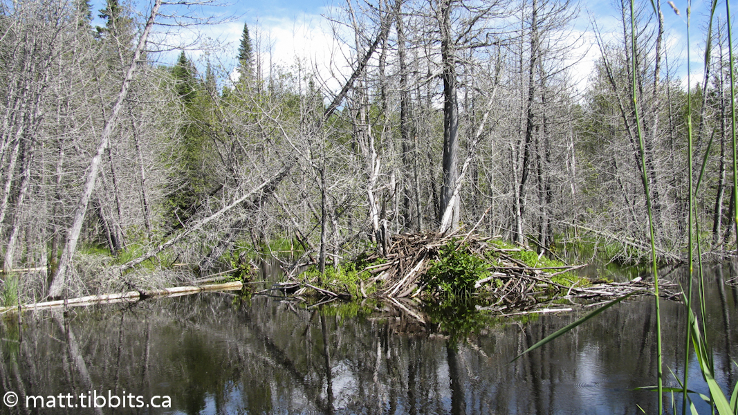
Shortly after starting out on the Border Trail I came across a shallow beaver pond blocking the trail. Some might try to cross around the edge. It clearly wasn’t very deep, so I took off my boots and waded. The cool water felt pretty good on the old feet. After about another 3 km on the trail you come to the Easton customs border station. This 3 km section of trail took about an hour to hike. This is not a trail where you can cover 5 km per hour. It is difficult. By this point I had hiked about 17 km and I was a hurting unit. There wasn’t really a single part of the day that had been easy. The mountain climb had been really hard on my Achilles, and it had been up and down ever since. I wanted to just lay down under a tree and die, so I was clearly going to have to suck it up to make it through to Fort Fairfield.
After another 3 km or so you come to a large orange gate. There is a road on the right that ends at the gate and an IAT sign that points left. I started left across the field and came to a another paved road. This didn’t make sense as I was heading west, when I should still be heading north. So I hiked back across the field and eventually found a trail that parallels the road that ends at the gate. The arrow on the IAT sign doesn’t mean to go left, it means to keep to the left of the road, on the US side. After about another 2 km I came to the infamous beaver pond. This used to prevent passage along this section of the Border trail, but the guide described a side trail that skirts the pond. I was worried, though, that it wouldn’t be passable and I would have to backtrack.
I can now say that it is passable, but barely. The trail really goes from bad to worse at this point. After skirting the beaver pond there is a very, very long section of swampy trail. There are places that I would push my hiking pole in to see how deep the muck was, and it would not hit bottom. I’m sure if I had have stepped in one of those spots I would still be there now. This section takes a lot of hopping from rocks to logs to clumps of grass, and a lot of patience. Not the easiest section of trail to hike when it feels like you have razor blades in your boots, but it is doable. If I had have known what to expect, it wouldn’t have been so bad. The problem was that I had expected easy, and had gotten very difficult instead. As it was this section of trail pissed me off so bad that anger alone carried me through. I feel like I got into a fight with the Maine wilderness, and although I didn’t win, I also didn’t lose. I think it was a split decision.
Eventually you do come up out of the swamp. From the beaver pond it is about 5 km to the lean-to. The Fort Fairfield lean-to is off to the right in a stand of pine trees. I was never so happy to reach the end of a trail. I thought the section between Bowlin Camps and Grand Pitch lean-to was bad, but this Border trail wins the prize. I arrived here around 5pm having hiked about 27 km on the day. I had been hiking in style, staying at motels or cabins for the past 3 days, so I thought I would continue into Fort Fairfield and find a room. Silly me. After leaving the trail and starting out on the Sam Everett Rd. I ran into a border agent. I stopped to ask her about lodging and she didn’t think that there was any, but she wasn’t sure. I figured that wasn’t possible and kept going. Eventually the road became populated with houses. Right before Rt. 167 I stopped to talk to a family that was out in their yard. They told me there wasn’t any place to camp or rent a motel room in Fort Fairfield. The closest place was in Andover, NB.
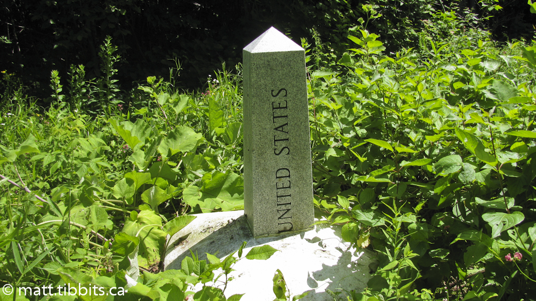

Since I didn’t want to back-track all the way to the lean-to, I didn’t know what else to do but to cross the border and keep heading into Perth-Andover. I decided to follow the road instead of the trail along the Aroostoock River, as I was just about walked out for the day. At Canadian customs the border agent said it was about 8km to the motel. I had now walked about 35 km on the day, so what was another 8? I just didn’t know if I could do it before dark. I lost an hour crossing the border into the Atlantic time-zone and it was now 8pm.
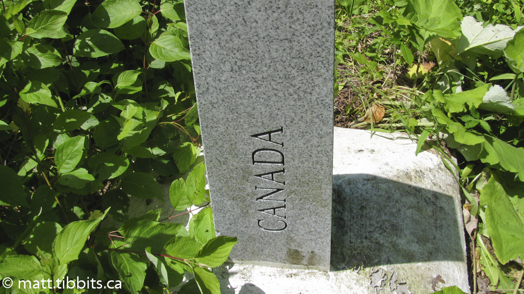
I headed into Andover on Route 190 with my thumb out. It seems the people travelling this road weren’t as friendly as the ones I encountered on my previous hitchhiking experience, since nobody even slowed, much less stopped to offer a lift. Or, maybe it’s because I was talking to myself and singing “I like to move it, move it”. I’m not sure, but either way somewhere along that road I think I approached the edge of insanity. Anyway, it turns out it was about 6 or 7km to the Perth Motor Inn from the border. When I came down over that hill and saw the motel I felt undescribable relief. I was finished the Maine section of the IAT in 7 days of hiking.
Day 8 total mileage: 41km
Conclusion
I have now been back for almost 2 weeks and it is clear that the trip took more out of me than I initially thought. I like to think that I’m in pretty good shape, and although I felt fine the first few days back, it was after these first days that I found myself to be incredibly sore and tired, and maybe even a bit blue. I am just now starting to feel my energy return. I also did definitely strain my right Achilles, with the silver lining there being that I at least did not rupture it. After much stretching, ice, and rest it is starting to get back to normal. I also lost 12 pounds in the 8 days I was gone, even though I ate like a pig pretty much the entire time.
The physical toll aside, I did, and still do, miss being on the trail. People often wonder why I do this type of thing, and especially why I do it alone. The closest I can come to explaining is that there is something about the combination of nature, solitude, and pushing yourself to the limit that calms me and allows me to put things into perspective. I don’t have any great, mystical nuggets of wisdom to share from the trail, but I can say that this type of experience leaves me feeling spiritually replenished and ready to go back to the grind of everyday life. At least for a while until I once again strap on my pack and head out on the trail.