Fundy Footpath First Edition
By Matt Tibbits on August 13, 2010
Description
The Fundy Footpath is a 49 km trail that spans between the Interpretive Center on the Fundy Trail Parkway near St. Martin’s, NB, all the way to Point Wolfe Campground, in Fundy National Park.
This is a rugged, backcountry footpath that will provide a challenging hiking experience. There are multiple, steep climbs and descents, rivers to ford, some of which can only be crossed at low tide.
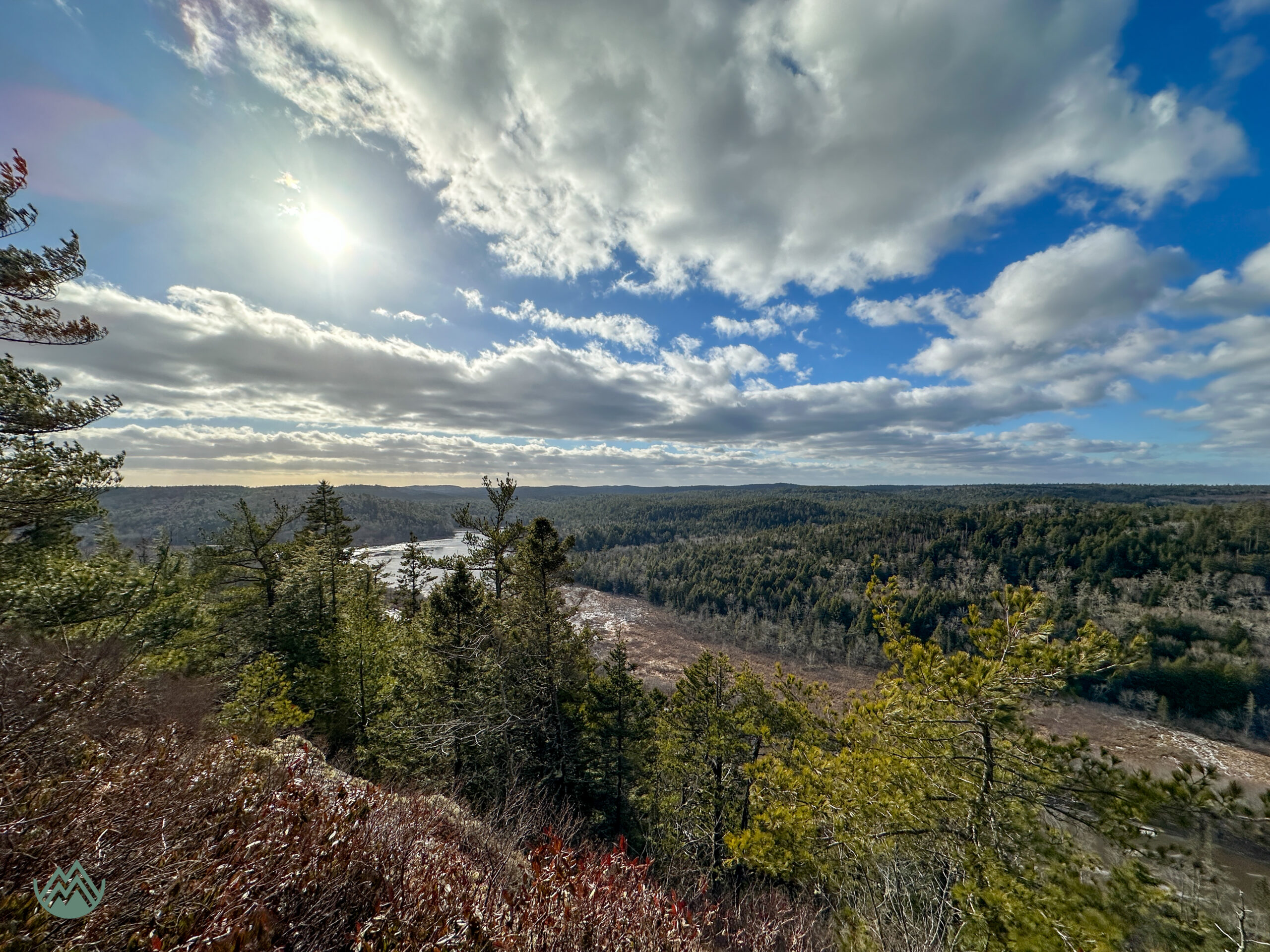
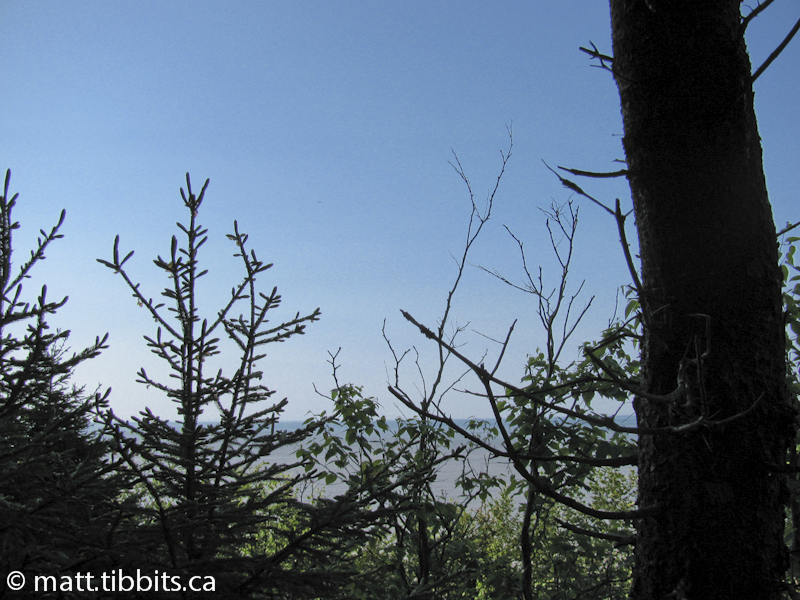
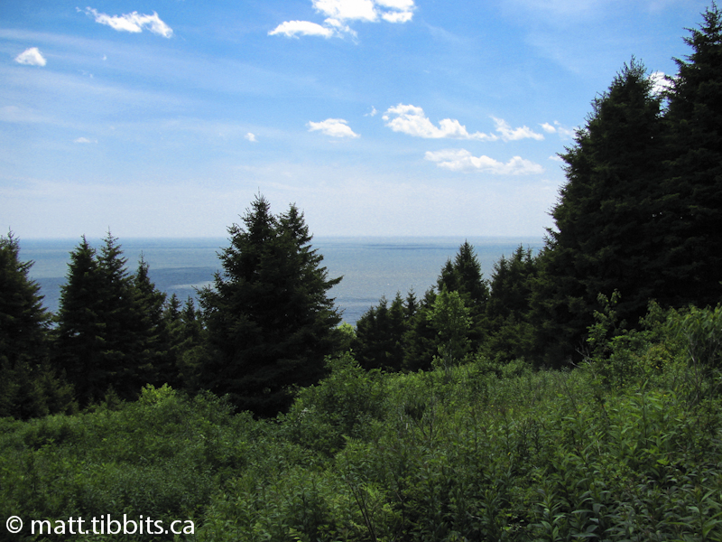
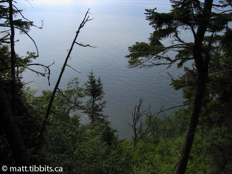
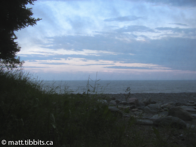
Although some might find this hike a bit challenging, the natural beauty of the Fundy coastline that you will experience make this one of the best that you will find in the Maritimes. Words cannot even describe the breathtaking views and scenery that you will find along the Fundy Footpath.
My Recommendations
After hiking the Footpath in July of 2010, I would make the following recommendations:
- Get the Fundy Footpath Guide – this booklet provides maps and detailed information on each section of the trail, along with a tide chart so that you can plan your river crossings to coincide with low tide. This is available from the Fundy Trail Interpretive Center, where you can order by phone, and also from The Radical Edge in Fredericton, NB. Proceeds from the cost of the guide go to help maintain the Fundy Footpath. You can also find more information on the Guide and the Footpath itself on the Friends of Fundy Footpath’s website.
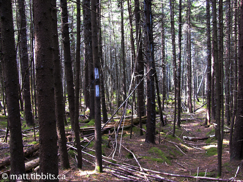
- FOLLOW THE BLAZES – hiking this trail will take you far from civilization and other people. If I could suggest one rule alone that will keep you on the Footpath it would be to “FOLLOW THE BLAZES”. The entire trail outside of Fundy National Park is blazed in white. If you find yourself walking along and you do not see any white blazes, retrace your steps to the last place where you saw a blaze because you are off of the trail. A double white blaze indicates that the trail will take a sharp turn. (NOTE: blue blazes denote a side trail and yellow blazes mark are access trails used for maintenance.)
- Don’t underestimate the Fundy Footpath – this is easy enough to do until you have hiked the trail. This is some very rugged terrain, and there is always the risk of extreme weather on the Bay of Fundy. Make sure that you are prepared, and that someone knows your itinerary. Also, you should register at the Fundy Trail Interpretive Center and let them know you have safely arrived once you finish your hike.
The following is my account of my first experience on the Fundy Footpath.
Day 1 – Big Salmon River to Little Salmon River
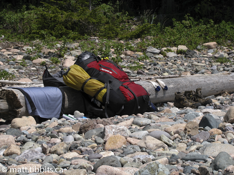
Here I am, 5 days worth of supplies crammed into a 38lb pack and on my way to hike the Fundy Footpath. This would be the first time that I ventured out on a multi-day thru-hike by myself. It’s 4:30am and really too early to feel anything, one way or the other, about what the coming days will bring.
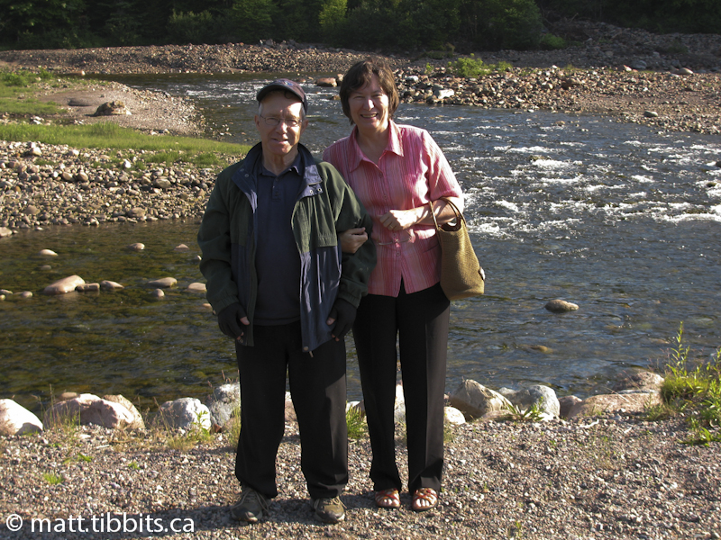
My parents kindly volunteered to drive me to St. Martin’s, NB, where I would begin my hike. The drive took about 2 hours from Fredericton. Once you reach St. Martin’s, you need to drive the Fundy Trail, a shared auto/bicycle/hiking trail that follows the Fundy Coast. The Footpath starts at the “Interpretive Centre”, located at the end of the Fundy Trail.
We arrived at the Interpretive Centre around 8:30am. Even though I had already registered that I would be hiking the Footpath, I checked in at the counter to make sure I was on the list. The lady working there confirmed that I was. Then she gave me a strange look and said “Are you really doing this by yourself!?”, to which I replied “Why yes, yes I am”. This seems to be a common response anytime that I mentioned hiking the Footpath: “YOU ARE WHAT?!… BY YOURSELF?!… BUT WHY?!”.
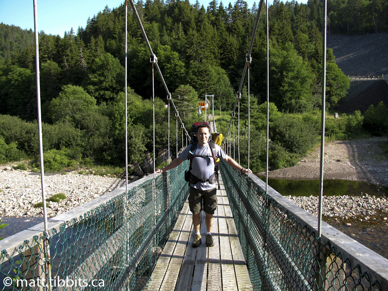
Wanting to get an early start, it was time to hit the trail. Mom and Dad walked me down to the suspension bridge that marks the start of the trail and we said our goodbyes. With a few butterflies in the pit of my stomach, I was off.
I started off hiking down the north side of Big Salmon River, as I hike I can see Mom and Dad on the other side walking back to the car, and then driving off. I suddenly realize that I really am out here all alone, and chances are I won’t be seeing too many people for the next 3 days. I push any doubts I have out of my head, tighten the straps, and start steppin’.
Big Salmon River to Long Beach
DISTANCE: 4km (approx)
TIME: 1.5hrs
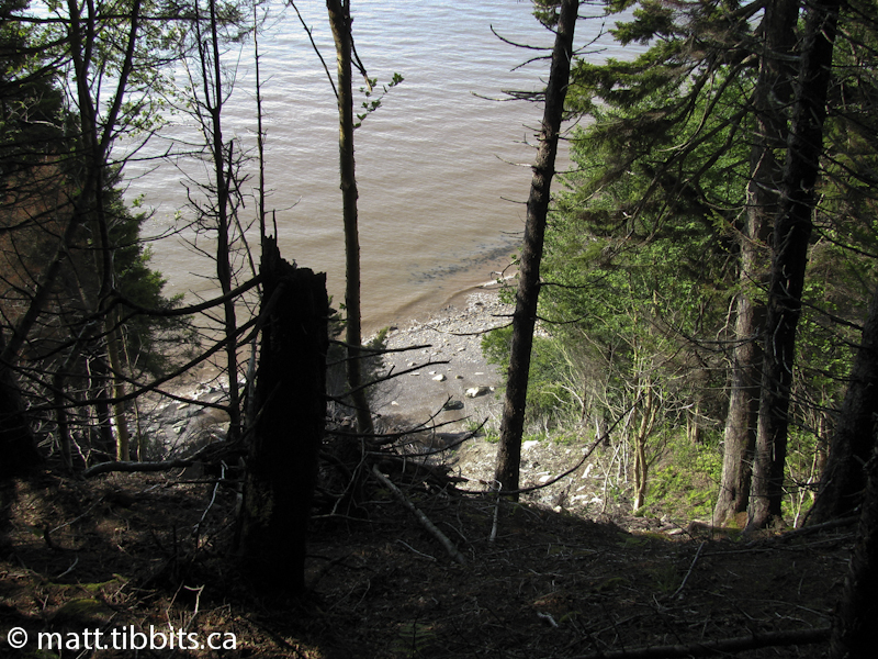
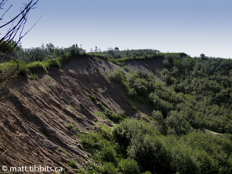
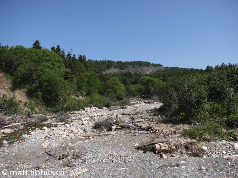
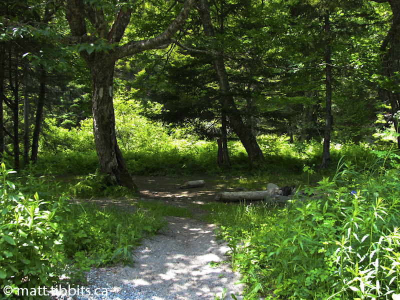
This leg of the hike starts out fairly easy. There is definitely a bit of a climb up from Big Salmon River, but nothing too serious. Even so, I’ve worked up a good sweat by the time I get to the top. Once up on the plateau the trail winds through the forest with some nice views of the Bay of Fundy. The trail then descends to Long Beach Brook, where I immediately lost the trail. I’m not sure if it is recent of not, but there is a major wash-out down along Long Beach Brook. I climbed down the wash-out and crossed the brook, and could not find the trail anywhere on the other side.
I started hiking along what looked like a trail, but 10 minutes in I realized that I hadn’t seen any white blazes since crossing the wash-out. That didn’t seem right, and this is where I realized that if you are on what you think is the trail, and it isn’t blazed white, then you aren’t really on the trail. This is when you immediately stop and retrace your steps to the last place that you DID see a white blaze. This goes a long way towards not getting lost.
So, I retraced my steps to Long Beach Brook and hiked up and down the eastern side of the brook trying to find the trail. I walked all the way down to the beach and still no trail. I could not spot anything that even looked like a trail, and there were definitely no white blazes to follow. I even hiked up the beach a ways thinking that maybe the trail could be spotted from there. Still nothing.
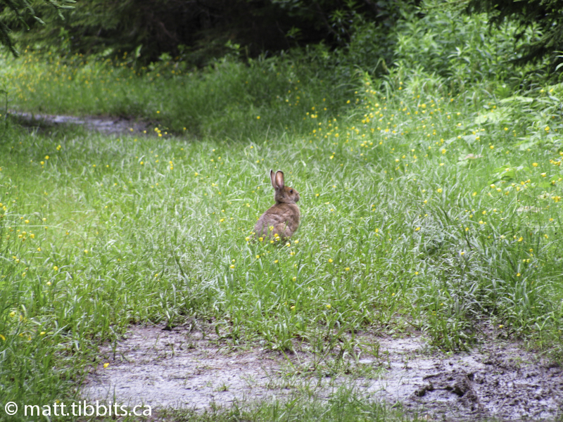
From the map I could see that the trail ran pretty much parallel to the beach. If nothing else, I could climb over the bluff from the beach and intersect the trail. This is where I experienced my first little bit of “trail magic”. As I was mentally preparing myself to start bushwhacking I caught movement out of the corner of my eye. Thinking it was another hiker, I turned to face the bluff and there stood one of the biggest buck deer I had ever seen. We stared at each other for a couple of seconds and then he whirled and bounded up what was visibly a trail of some sort. Without really even thinking about it I started following this trail. It wasn’t even a 2 minute hike before this game trail intersected the Footpath. I was very happy to see white blazes again, and very grateful to the deer for nudging me in the direction of the trail.
Long Beach to Seely Beach
DISTANCE: 3.8km (approx)
TIME: 1hr
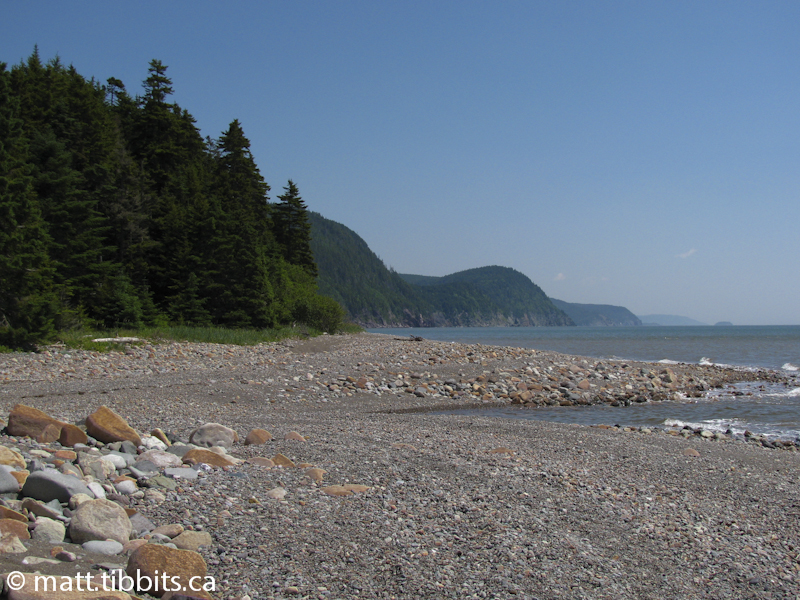
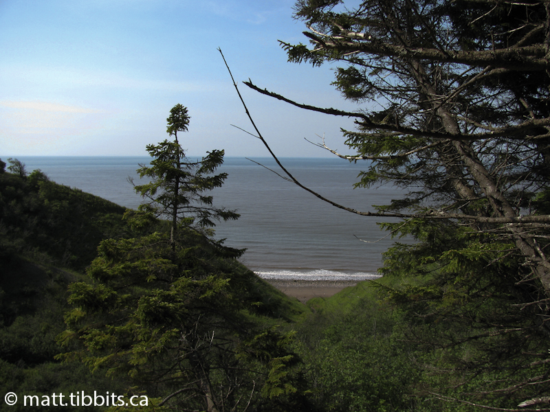
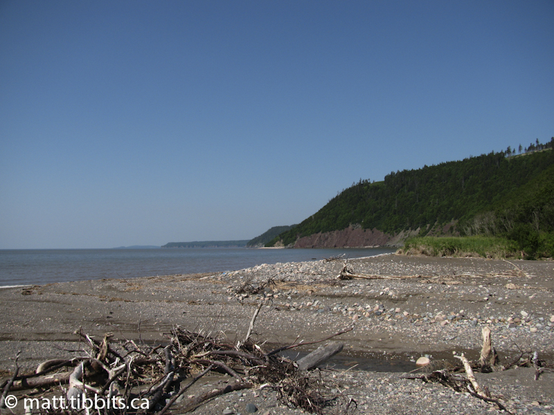
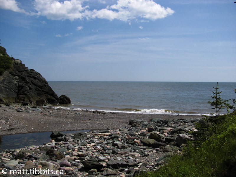
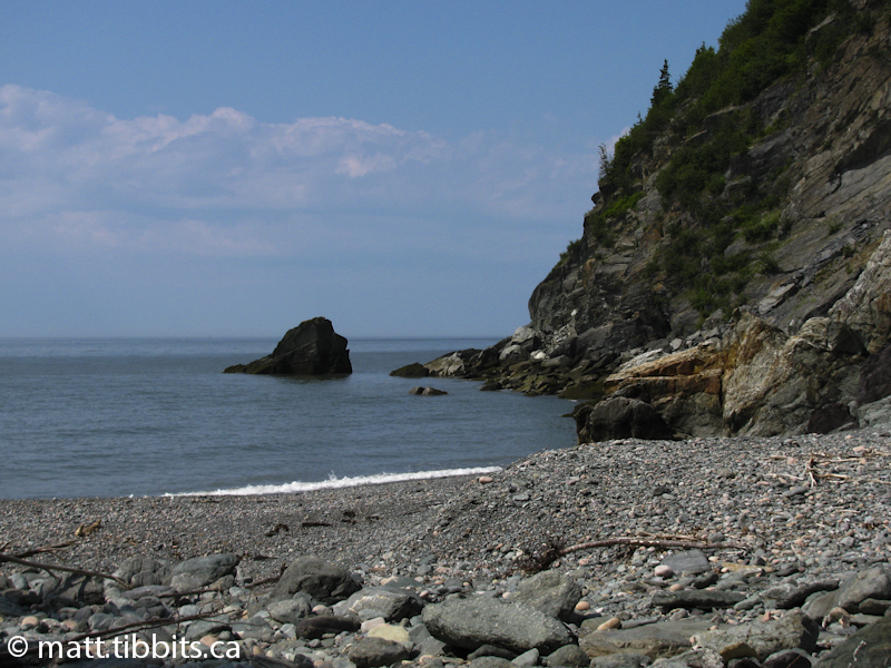
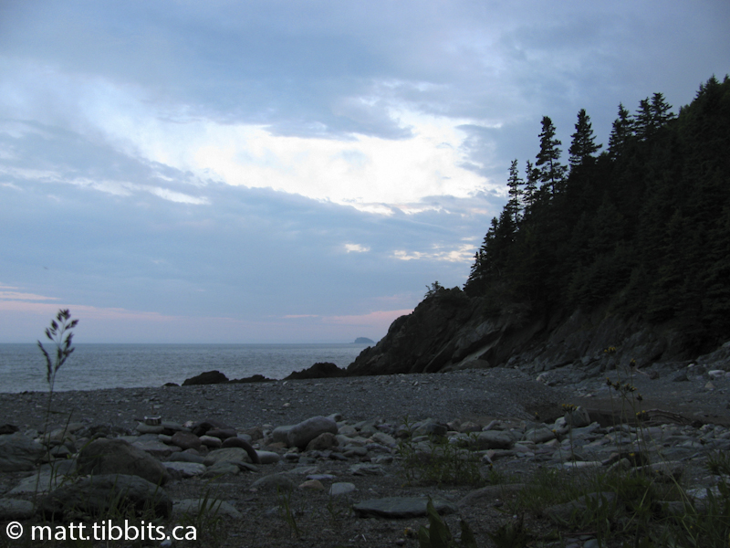
This part of the Footpath is relatively flat with some spectacular views. Once you reach Seely Brook, cross the brook and continue up the beach where you will see a campsite set back in a clearing just above the beach. The beach here stretches out in both directions almost as far as the eye can see.
When I arrived here it was a cloudless, sunny sky and there was not a sound other than that of waves breaking on the beach. What an awesome feeling of solitude. I was all alone, but yet it felt so peaceful. The silence was so loud you could almost hear it. I try to describe it, but really, other than being there, there is no way to understand the feeling.
After passing the campsite, continue along the beach to where the trail ascends up the cliffs.
Seely Beach to Cradle Brook
DISTANCE: 4.3km (approx)
TIME: 1.5hrs
So far the trail had been pretty easy. There were a few climbs and some navigation problems, but nothing too crazy. This is where the hike started to get serious. From Seely Beach the trail started straight up a cliff, and I do mean straight up. This ascent was aided by 2 cables with 4×4’s strung between them to help get a foothold. From here to Cradle Brook the uphills make you want to puke and the downhills make you want plastic knee replacements.
When you do finally descend to Cradle Brook go up the brook a short distance, cross the brook, and the trail continues from here.
Cradle Brook to Little Salmon River
DISTANCE: 5.2km (approx)
TIME: 2.25hrs
This leg of the trail is more of the same, although the ups and downs are not quite as long as the previous section. When you arrive at Little Salmon River, walk up river and you will see a sign across the river on the eastern side. This is where I crossed the river, but not without getting both feet good and wet. It might be a good idea to use water shoes or sandles so that you can keep the boots dry. It really depends on how high the river is.
Once I reached the eastern side of the river, I again found it hard to find the trail. After wandering up and down for a bit, I was able to find it. Go through the brush about 100m in the direction of the sign that you can first see before crossing the river. There are a set of makeshift steps here that go up. It is only a short hike to where the Eastern Section of the footpath intersects the Dustin Brook access trail, which is blazed in yellow rather than white. There is a campsite here, and one about 2 minutes up the access trail on Dustin Brook itself.
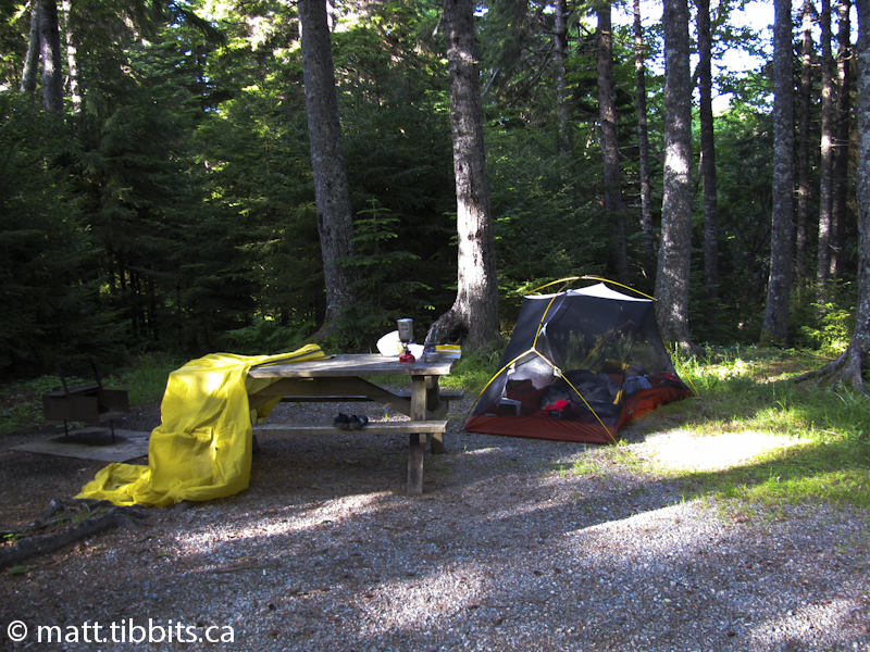
At this point I was pretty beat. I had hiked the entire western section of the Footpath in the first day. For some reason I was expecting some kind of a paradise-like campsite when I reached Little Salmon River. The first site was in the forest itself under a canopy of pine. It seemed awful dark and dreary, and I was pretty sure that the trees were going to come alive after dark and eat my soul. The second site was a little better. Just a short ways up the Dustin Brook access trail, it was surrounded by mountains in a small clearing on the shore of Dustin Brook.
I was again struck by how alone I was, although now it didn’t feel so peaceful. I was suddenly plagued with doubts and wondering what the fuck had possessed me to want to do this by myself in the first place. Whatever the answer to that question was, there wasn’t a whole lot I could do about it now. It was 18km in one direction and at least 23 in the other and I was hitting the wall. My feet were already growing massive blisters, my good knee had suddenly become my bad knee, and every muscle hurt. All I wanted to do was get some food into my system, and then crawl into my sleeping bag and feel sorry for myself.
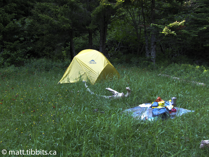
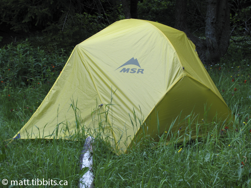
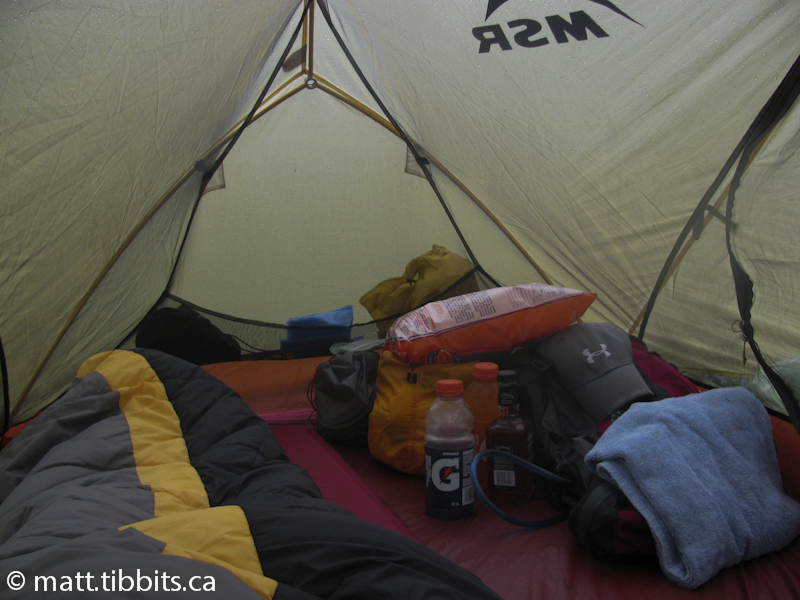
I managed to get my boots off and set them out in the last little patch of sun in hopes that they would dry out a little bit. I hobbled around in my bare feet and got my tent setup and started on supper preparations. It’s amazing the difference a good meal can make. After eating I immediately started feeling better, at least mentally. I was still worried about my knee holding up, as the worst of the trail was still to come, but the negative thoughts were gone. I bear-bagged my food, crawled into my tent, and I was asleep before my head even hit the pillow.
Day 2 – Little Salmon River to Azore Beach
I woke at 6:30am on day 2 to a cool, overcast morning. I packed up and after a quick snack hit the trail by 7:15. I was a bit sore, and my feet felt like my boots were lined with barbed wire, but otherwise I was ready to go. My goal for today was to hike about 16km to Goose Creek and then camp there for the night.
Little Salmon River to Rapidy Brook
DISTANCE: 2.5km (approx.)
TIME: 1hr
A short hike back to where the Dustin Brook access trail intersects the Footpath and then you veer off to the left and the eastern section of the footpath. As a perfect way to start the day I immediately had to climb one of the longest, steepest ascents yet. Multiple switchbacks lead up the cliff and the climb seems to never end, although there are some pretty spectacular views of the Little Salmon River delta on the way up. Once you do reach the top you can catch your breath as the trail is relatively flat through a marshy area of the forest.
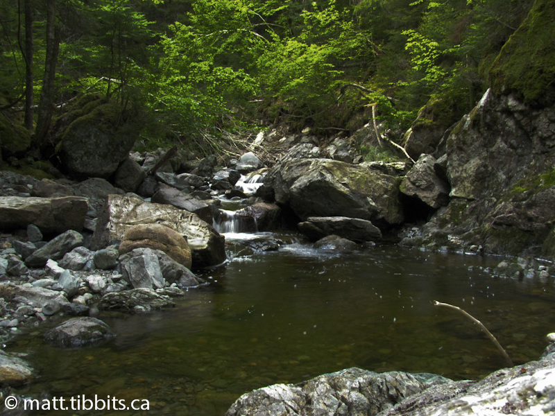
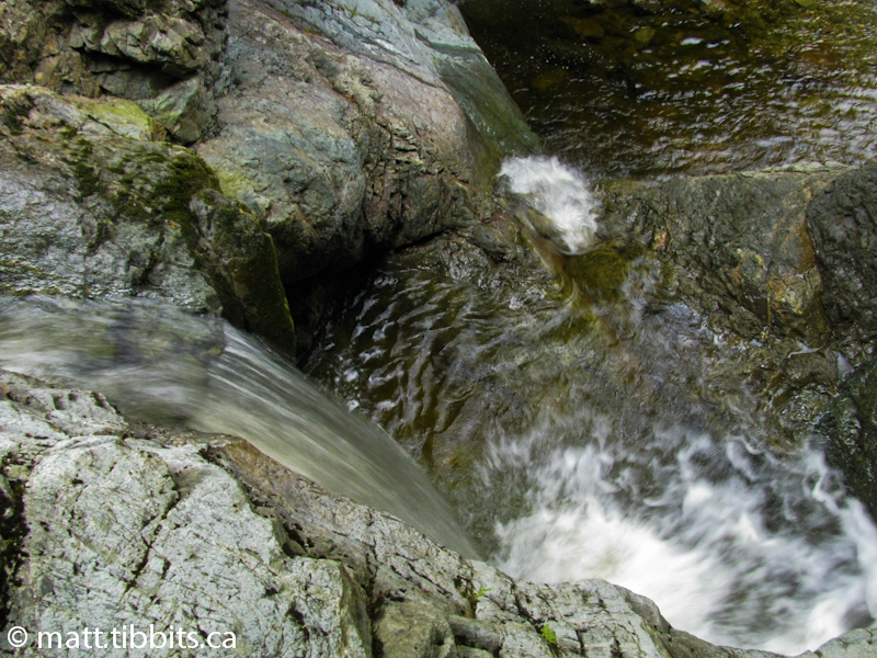
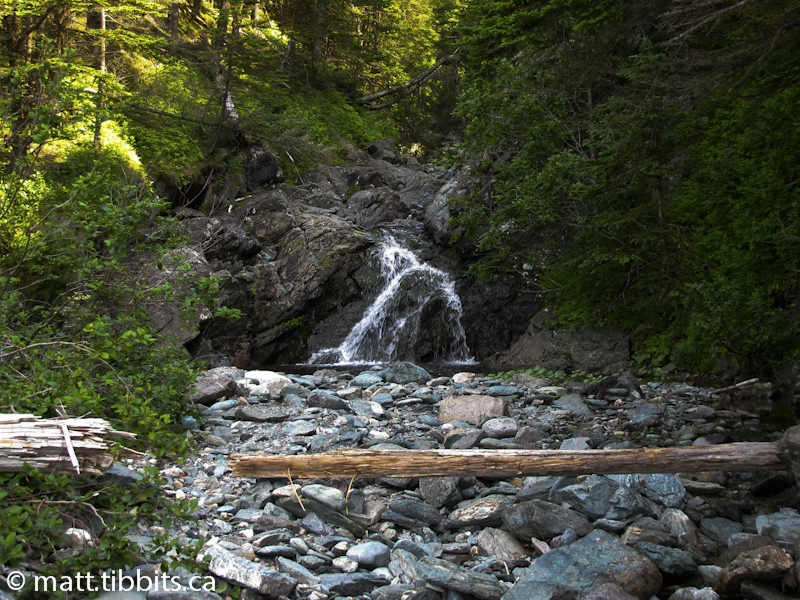
The trail then descends to Rapidy Brook where you can stop and check out the waterfalls. By the time I arrived here I had only been on the trail an hour, but I was already hurting. The descent from the plateau to Rapidy had my left knee screaming in pain, and my feet were getting worse with each step. As much as I wanted to stop here, I had a lot of ground to cover. Continue across Rapidy Brook and then there is another steep ascent.
Rapidy Brook to Wolf Brook
DISTANCE: 2.5km (approx.)
TIME: 1hr
Another steep ascent, a plateau, and then descent to Wolf Brook. When you reach the brook you will see some old logging dams. Pass these and walk towards the bay for both the trail and a campsite.
Wolf Brook to Telegraph Brook
DISTANCE: 2.5km (approx.)
TIME: 1hr
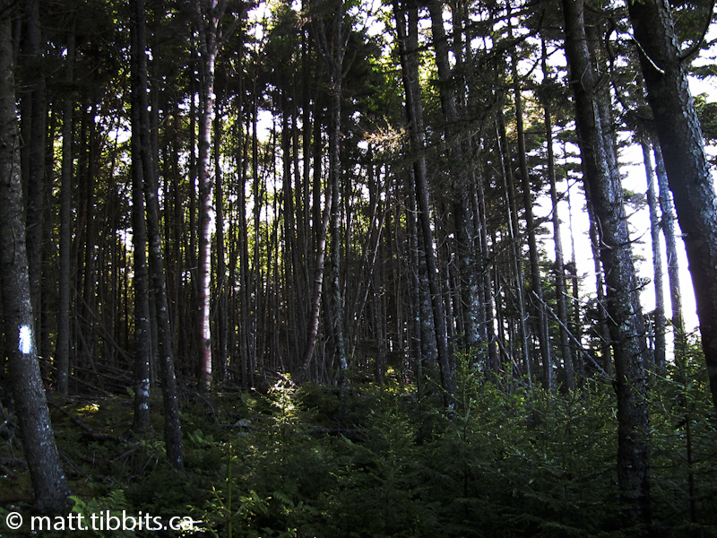
Steep ascents from each brook to a plateau and then a descent to another brook. Even though each step was excruciating I still couldn’t help but notice and appreciate the beauty of the forest. The distances that I recorded from place to place could be (and probably) are a bit off for this section, as I was more focused on putting one foot in front of the other than I was on recording details and taking pictures.
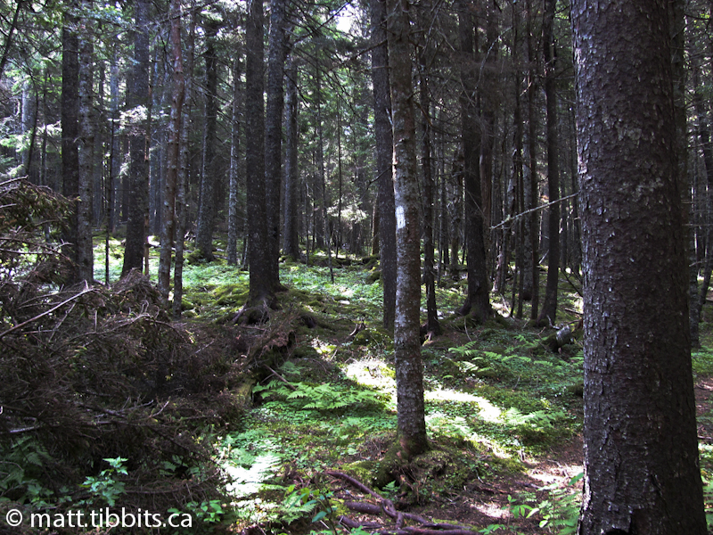
The forest between Wolf Brook and Hunter Brook is beautiful, and is aptly called the “Enchanted Forest”. From Hunter Brook to Telegraph there is a quick ascent, then a descent to Telegraph Brook.
Telegraph Brook to Quiddy River
DISTANCE: 4km (approx.)
TIME: 1.5hr
Again, I don’t have much to report on this section. I wanted to take more time to enjoy the scenery along the trail, but by this point I was in the “zone”. I had pretty much blocked out all pain, and was only focused on staying hydrated, eating a snack at regular intervals, and keeping one foot going in front of the other.
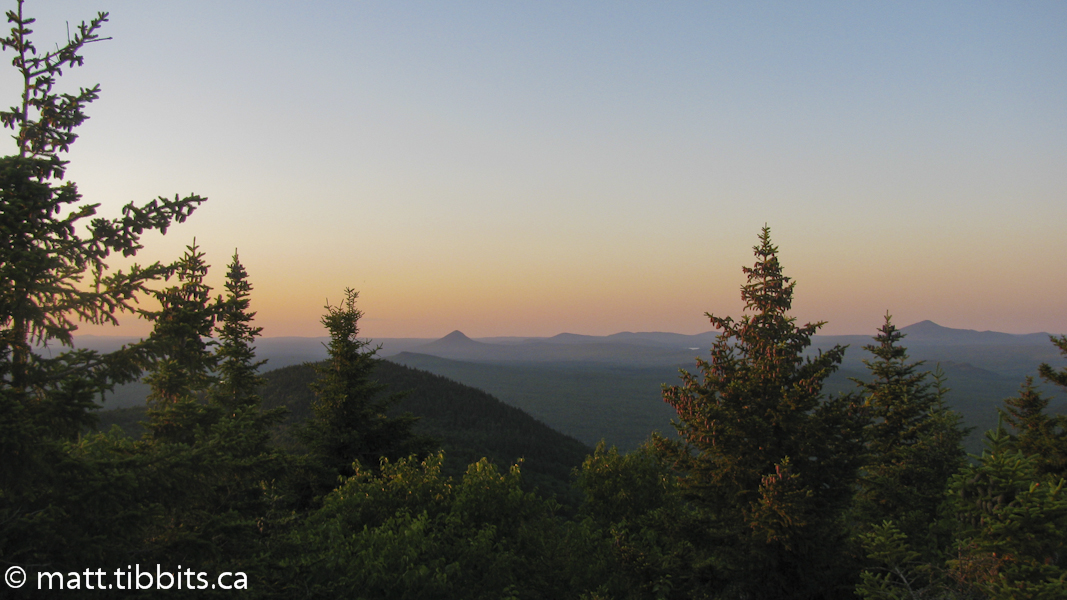
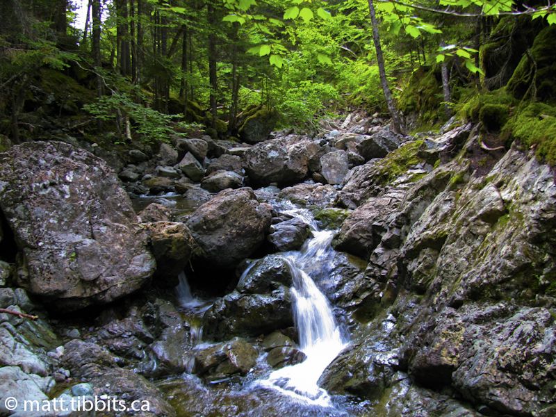
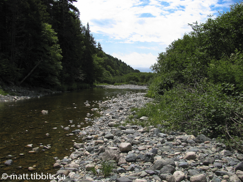
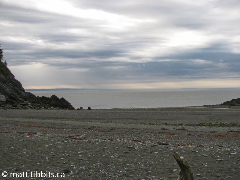
It was just past lunchtime when I descended to Quiddy River, and what a beautiful spot to stop for a break. Just as I arrived, the sun broke from the clouds. The sparkling river flowing down over a rocky river bed to the Bay of Fundy definitely helped to lift my spirits. I had a nice peaceful lunch with my aching feet soaking in the cool river water. I could have easily spent the rest of the day here, relaxing in the sun.
There is also a nice, grassy, riverside campsite here, that in my opinion, is one of the nicest spots along the Footpath.
As much as I didn’t want to get up, I still had lots of trail ahead of me.
Quiddy River to Goose Creek
DISTANCE: 6km (approx.)
TIME: 3hr
After a nice relaxing break, it wasn’t easy coaxing my aching feet back into my boots. After crossing the Quiddy the trail ascends steeply to where it crosses Martin Head Road. The trail then parallels the road until it crosses an ATV trail. At this point you come into a clearing where it is I again lost the trail, but using my map I was able to quickly find it again. If you follow the ATV trail about 10m to the left, then turn right into the woods you will see a white blaze right away. From here on it is quite easy to continue following the trail.
The next portion of the trail is made up of numerous switch backs that go up and down along the top of the cliffs. There are many excellent views of Martin Head and the Bay from this section.
A note on camping in this area: the guide book cautions that weekends can get quite rowdy around Martin Head, and that is very accurate. I passed through this area on a Saturday afternoon and there were a lot of people using the ATV trails to access the beach. As I hiked along I could hear the sounds of engines revving, ATVs racing, and people yelling. I could also smell the mouth watering odor of hot dogs and hamburgers BBQing on the beach, and was very tempted to crash the party to bum something to eat other than trail mix and energy bars.
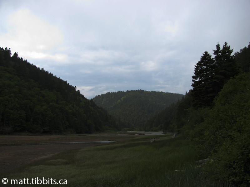
When you finally arrive at Goose Creek there is a lovely campsite just inside the tree line beside the beach. To stay on the trail, continue following the tree line up the creek. You will see a Fundy Footpath sign on the western side, and a large white sign on the eastern side of the creek, where the trail continues. You can cross at any point here, although you will need to wait for low tide as the water is way too deep at high tide.
I arrived here around 4pm and decided to keep going, rather than stop for the night. The original plan was to stop here, and then hike to Goose River the following day and cross at low tide. After checking my tide table I realized that low tide was around 6pm, and with only 7km to go, I was going to spend a good part of the day waiting for the tide to go out. Since I was already beyond feeling any pain, and since there was lots of daylight left, I decided to keep going and camp at Azore Beach. This would allow me to catch low tide first thing the next morning, and then I would only have about 8km to reach Point Wolfe campground in Fundy National Park. I was thinking I could arrive by noon and then have the remainder of the day to rest my aching feet.
After crossing Goose Creek, I stopped to have a good snack, then it was time to tackle the next ascent.
Goose Creek to Azore Beach
DISTANCE: 3.5km (approx.)
TIME: 2hr
This leg of the hike was absolutely brutal. I really felt like I was running on empty. I ran out of water just after reaching the top of the ascent from Goose Creek. I figured it was between 3 and 4 kilometers at the absolute most until I reached Rose Brook, which flows out to the Bay at Azore Beach. It was just a simple question of putting my mind to it, blocking out the pain and fatigue, and pushing forward.
In retrospect, I think I was a bit out of it mentally. I passed a brook, that I assumed was Jim Brook, and according to my map the next brook would be Rose Brook. When I reached the next brook, the trail switch-backed up another cliff and there wasn’t any beach or campground in site. I couldn’t understand it. I tried hiking down the brook thinking the beach would be right there, but this was pretty much impossible. All I could do was keep following the trail. Worst case scenario I would end up at Goose River itself, and could spend the night there.
I filled my water bladder so that could at least stay hydrated, and returned to the trail. After ascending the cliff, I then passed the Jim Brook access trail and realized that I had actually just crossed Jim Brook, not Rose Brook. I felt pretty foolish, but at least I knew where I was. I can’t describe the relief when I finally descended to the beach and crossed Rose Brook.
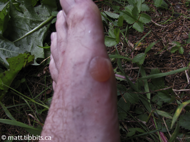
The campground at Azore Beach is on the eastern side of the brook, up against the cliff. There was a trail right beside my tent, so I figured that I would have no problems leaving before dawn the next morning. I had hiked about 21km today, and it had taken a toll. My feet were bloodied and I had huge blisters. At this point, I was so dizzy I could hardly setup my tent. I sprawled half in and half out of my tent and managed to get some supper cooked. As I laid there, I could see a front rolling in from the Bay of Fundy bring heavy fog and clouds with it. It was pretty neat to see the clouds just barreling in over the Bay of Fundy and obliterating the setting sun. I had a pretty good idea that the next morning was going to be a wet hike, but at least the end of that hike would bring a nice warm shower and a good rest.
Day 3 – Azore Beach to Pointe Wolfe Campground
I woke up Sunday morning around 4:30am to a steady rain falling. I wanted to be on the trail by 5 so that I could catch low tide which was around 6:15am. The guide suggests crossing within a 4 hour window of low tide, so I figured that at the absolute latest I should cross by 7am.
Azore Beach to Goose River
DISTANCE: 2.5km (approx.)
TIME: 1hr
I packed up and started up the trail that I had spotted the previous evening. I hadn’t even gone 30 meters when the trail came to an abrupt and sudden end. What the fuck? I was in no mood at all on this particular morning to be searching for the trail. I was tired, my feet were bleeding, and I was stumbling around in a pre-dawn downpour trying to spot the trail by the light of my headlamp. I climbed back down to the beach and immediately spotted another trail. Scrambled up it, and no white blazes. This trail also ended abruptly. I spent the better part of an hour searching for the damned trail. My map had a huge crease right at the spot where I was, so that was no help. I was getting pissed. By now, it was around 6am, and I really wanted to cross into Fundy Park this morning and NOT this evening.
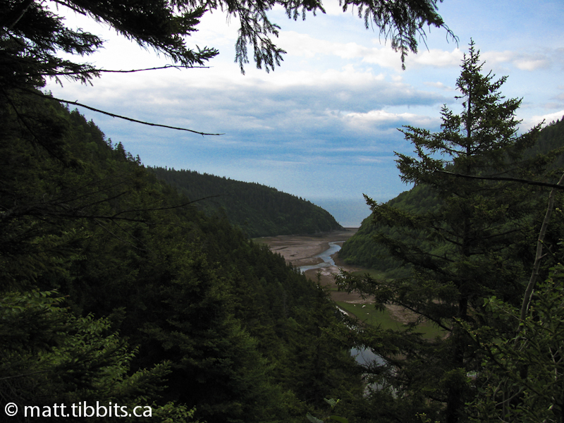
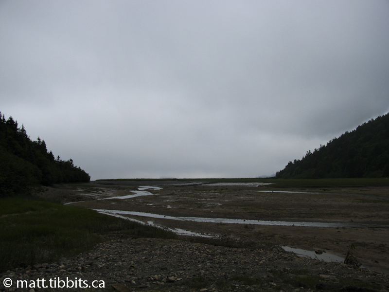
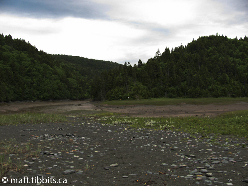
Finally, there was enough natural light that I could spot a white blaze on a rock in Rose Brook. Once I spotted the first one, I was on my way. The trail leads up the brook a short distance and then ascends up out of the ravine. I arrived at Goose river around 7am. Goose River itself is crossed by walking over an old logging dam. You then follow the River down the eastern side, over the mud flats, until you come out on a point where Rossiter Brook joins Goose River. It is here that you cross. Scramble up the eastern side of Rossiter Brook and you are rewarded with a spectacular view of the Bay. Cross this rocky point and you will see a Fundy Park sign that announces the Goose River Trail.
Goose River Trail
DISTANCE:8km (approx.)
TIME: 2hr
Once you reach the Goose River Trail you are within the Fundy National Park trail system. This trail leads to the Point Wolfe parking lot and campground. There are still a few good ascents and descents, but the trail is nice and wide, with a gravel surface, so you can make pretty good time. I was pretty anxious to reach the campground and crash. My first order of business would be to get a nice cold can of Coke from a vending machine and then take a long, hot shower.
When I reached Point Wolfe campground and registered it was around 10am. Many of the sites were still taken as campers had yet to check out. The girl at the kiosk was very friendly and said that if I didn’t like my spot, I could come back around noon and change it. I thought the site would be fine, and asked her where the vending machines were. The anticipation, and the subsequent disappointment when she said there weren’t any must have been written all over my face. To make up for it she offered me a Fresca. It wasn’t a Coke, but it was the best damn Fresca I’ve ever had.
I was pretty exhausted by the time I finished setting up my tent. I hobbled down the road a couple of times to the kiosk to phone my parents so that I could arrange a pickup for Tuesday morning. Since all my socks were hanging to dry, I had to walk the kilometer back and forth from my tent to the phone with bare feet in my boots. My emotions at this point were a roller coster ride between rage and wanting to just sit down in the middle of the road and cry.
I’m not sure how to describe the conversation with my mother, but either something I said, or the bad connection, or both, apparently caused her to become quite worried. I was woken up around 10pm with a flashlight shining through my tent, and someone calling my name. When I replied that “Yes, this is Matt Tibbits” and asked what was wrong, he said that my mother and the police were looking for me. My heart skipped a couple of beats, as I was thinking something must have happened to someone at home. But no, that wasn’t it. Turns out my mother was so worried about me that she called the RCMP, who in turn contacted a staff member at the Fundy Trail Interpretive Centre and also the administrator of Fundy Park. It was this gentleman who woke me up to see if I was ok. I assured him that I was, and that all I really needed was a good nights sleep.
It was a bit embarrassing at the time, but in retrospect I can’t help but laugh when I think of the whole situation. I was fine, but it’s nice to know that were something seriously wrong, between my family and the park staff, I would have been taken care of.
Day 4 – Point Wolfe Campground to Headquarters Campground
The plan for Monday was to hike the Coastal Trail which takes you from Point Wolfe campground to the Headquarters campground in Fundy Park. As I left the campground the park administrator was there at the kiosk. He let me use the phone to call home, and I assured everyone that I was fine to continue.
The Coastal Trail
DISTANCE: 10km
TIME: 2.5hr
This is a pretty easy trail compared to the intense ups and downs of the Fundy Footpath. There are still some ascents, but overall the trail is fairly easy. It started to pour rain just as I reached the trail head. The only hard part of this hike was to watch out for the wet and slippery roots and rocks along the path.
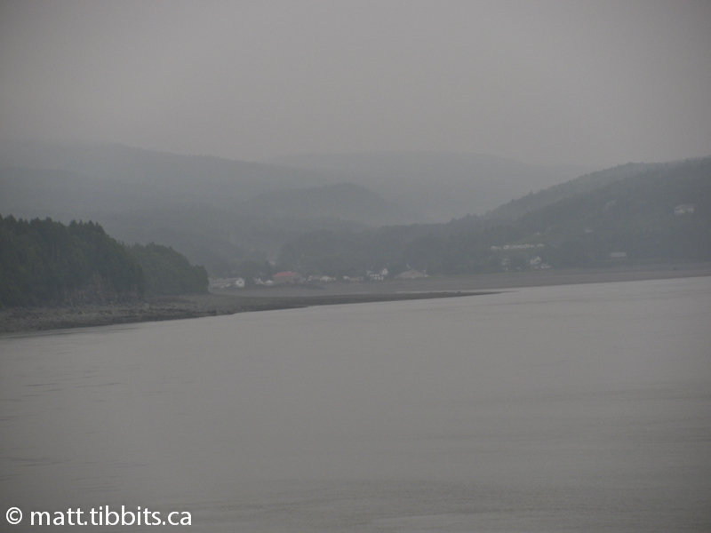
When I came around a turn and was treated to a distant view of the village of Alma I knew I was on the home stretch. The very first thing I planned on doing was hiking down to the Fundy Takeout in Alma and getting the biggest seafood platter you’ve ever seen.
When I finally reached the Headquarters campground I was soaked to the core. I rushed to setup the tent in the rain, so that the interior stayed dry. I was able to do some laundry and get a hot shower. After eating there wasn’t much to do but hunker down in my tent out of the rain and do some reading. A few shots of Jack Daniels helped me quietly celebrate the completion of the Fundy Footpath.
Conclusion
All in all I am pretty satisfied with this experience. I managed to cover 60km in 4 days, and complete the Footpath, despite some rookie mistakes. I have to admit that I definitely underestimated this trail. The intense ascents and descents do take their toll, and I was not prepared for that. Once the blisters developed there wasn’t much to do, but suck it up and keep going.
I would recommend that anyone who loves wilderness hiking make a point to hike this trail. I most certainly plan on hiking this trail again someday, but next time I will go a bit slower and take more time to appreciate its beauty.